| dc.creator | Geological Survey (U.S.) | en_US |
| dc.date.accessioned | 2014-02-20T20:09:07Z | |
| dc.date.available | 2014-02-20T20:09:07Z | |
| dc.identifier | 150844 | en_US |
| dc.identifier.uri | http://hdl.handle.net/1721.3/158659 | |
| dc.description | detail | en_US |
| dc.relation.ispartof | 141830 | en_US |
| dc.rights | (c) Massachusetts Institute of Technology, photograph by Julie Johnson | en_US |
| dc.subject | Suburbs | en_US |
| dc.subject | Topographic maps | en_US |
| dc.subject | Housing developments | en_US |
| dc.subject | Massachusetts -- Maps | en_US |
| dc.subject | Geological Survey (U.S.) | en_US |
| dc.subject | Billerica (Mass.) | en_US |
| dc.subject | Massachusetts -- Maps | en_US |
| dc.subject | Geological Survey (U.S.) | en_US |
| dc.subject | Boston Suburbs - Chapter 3 - 1910-1920 | en_US |
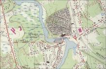
| dc.title | U.S. Geological Survey Map of Billerica Garden Suburb in North Billerica, Massachusetts | en_US |
| dc.type | Image | en_US |
| dc.rights.access | All rights reserved | en_US |
| dc.identifier.vendorcode | 3.305 | en_US |
| vra.culturalContext | American | en_US |
| vra.technique | cartography | en_US |
| vra.worktype | Map | en_US |
| dc.contributor.display | cartographer: Geological Survey (U.S.) (American, founded 1879) | en_US |


