| dc.coverage.spatial | Creation location: Hyderabad (Andhra Pradesh, India) | en_US |
| dc.creator | Sherwani, Haroon Khan | en_US |
| dc.date.accessioned | 2007-08-21T19:18:01Z | |
| dc.date.available | 2007-08-21T19:18:01Z | |
| dc.identifier | 109529 | en_US |
| dc.identifier.uri | http://hdl.handle.net/1721.3/20262 | en_US |
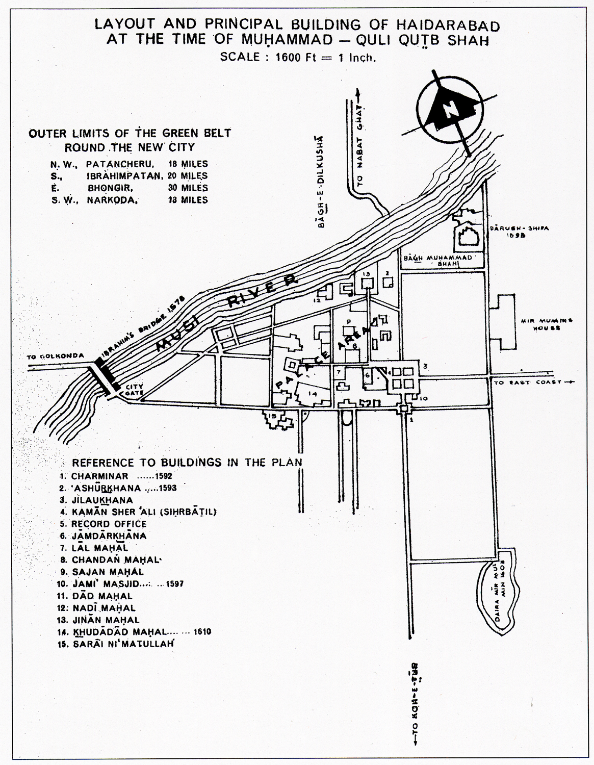
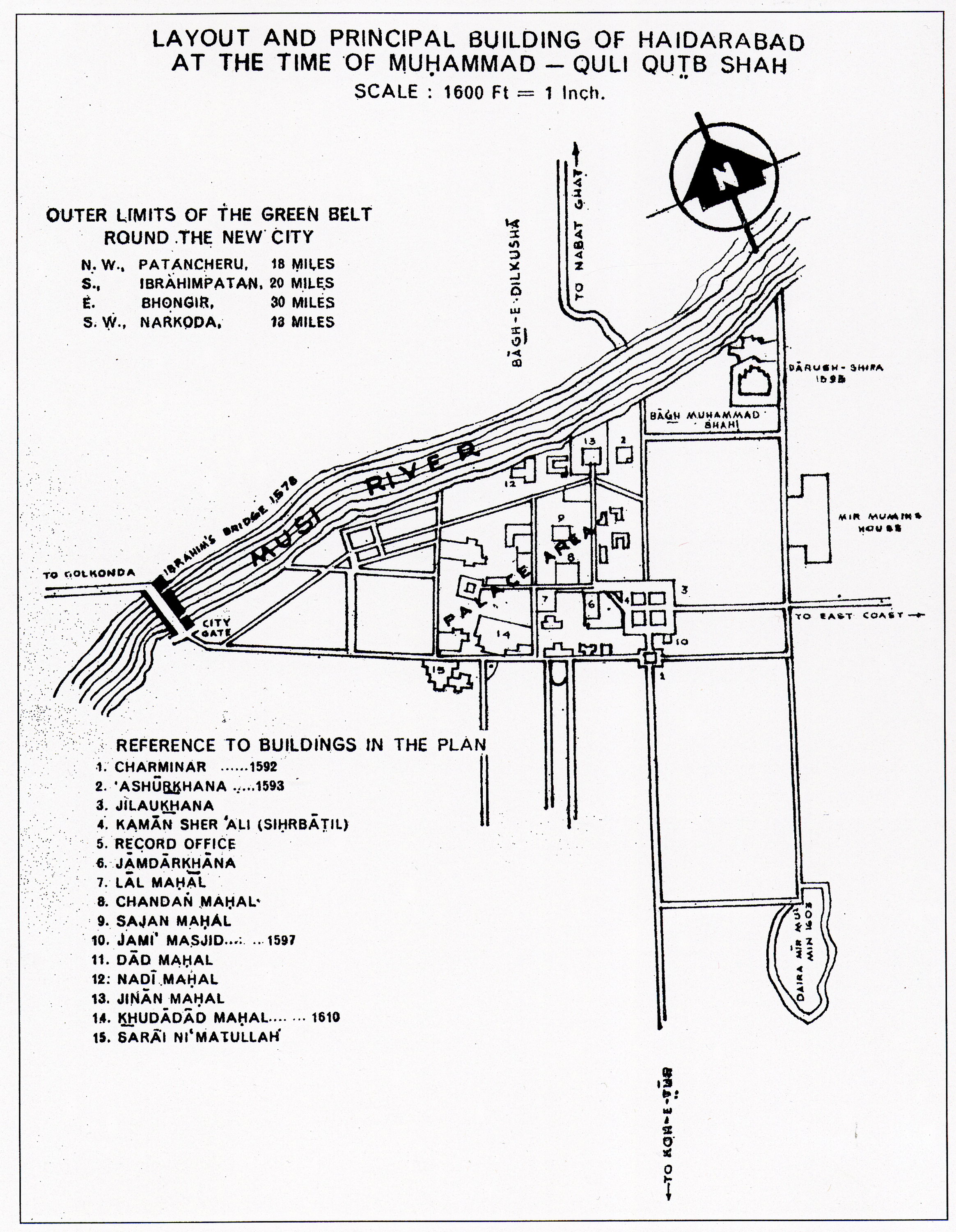
| dc.description | full view, Drawing depicting the layout and principal buildings of Hyderabad during the time of Muhammad-Quli Qutb Shah (reg. 1591-1600s). Map by Haroon Khan Serwani.
, 1976 | en_US |
| dc.format.medium | paper (fiber product) | en_US |
| dc.format.medium | ink | en_US |
| dc.relation.ispartof | 130016 | en_US |
| dc.rights | (c) H.K. Sherwani | en_US |
| dc.subject | Buildings | en_US |
| dc.subject | Cartography | en_US |
| dc.subject | India | en_US |
| dc.subject | Maps | en_US |
| dc.subject | Cities and towns | en_US |
| dc.subject | Land use, Urban | en_US |
| dc.subject | Hyderabad (India) | en_US |
| dc.subject | Plans (maps) | en_US |
| dc.subject | Muhammad Quli Qutb Shah, Sultan of Golkunda, 1565-1612 | en_US |
| dc.subject | Qutb Shahi dynasty | en_US |
| dc.title | Layout and Principal Buildings of Hyderabad at the Time of Muhammad-Quli Qutb Shah | en_US |
| dc.type | Image | en_US |
| dc.rights.access | All rights reserved | en_US |
| vra.culturalContext | Indian (South Asian) | en_US |
| vra.technique | cartography | en_US |
| vra.worktype | Plan (map) | en_US |
| dc.contributor.display | cartographer: Haroon Khan Sherwani (Indian (South Asian), born 1891) | en_US |