| dc.coverage.spatial | Site: Massachusetts (United States) | en_US |
| dc.coverage.temporal | creation date: assigned along local roads from Milton to Salem, 1927, other date: opened as a four lane highway, 1951 | en_US |
| dc.creator | Massachusetts. Dept. of Public Works | en_US |
| dc.date | 1927 | en_US |
| dc.date.accessioned | 2014-03-04T16:42:06Z | |
| dc.date.available | 2014-03-04T16:42:06Z | |
| dc.date.issued | 1927 | en_US |
| dc.identifier | 140716 | en_US |
| dc.identifier.uri | http://hdl.handle.net/1721.3/160172 | |
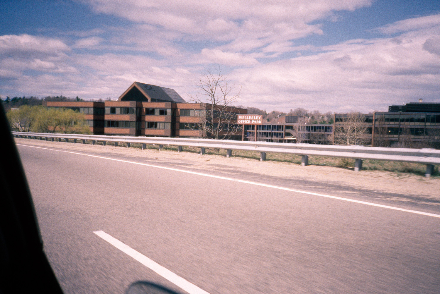
| dc.description | Route 128, opened as a four lane highway 1951; first multi-lane circumferential highway in metropolitan area; located at a 10-mile radius from Boston. | en_US |
| dc.description | general view, Wellesley Office Park seen from Route 128, 1987 | en_US |
| dc.relation.ispartof | 139404 | en_US |
| dc.rights | (c) Massachusetts Institute of Technology, photograph by Lois A. Craig | en_US |
| dc.subject | Highways | en_US |
| dc.subject | Suburbs | en_US |
| dc.subject | Transportation | en_US |
| dc.subject | Beltways | en_US |
| dc.subject | Massachusetts Route 128 (Mass.) | en_US |
| dc.subject | Commercial buildings | en_US |
| dc.subject | Wellesley (Mass.) | en_US |
| dc.subject | Office parks | en_US |
| dc.subject | Boston Suburbs - Chapter 5 - 1940-1960 | en_US |
| dc.title | Massachusetts Route 128 | en_US |
| dc.title.alternative | Yankee Division Highway | en_US |
| dc.title.alternative | Circumferential Highway | en_US |
| dc.type | Image | en_US |
| dc.rights.access | Creative Commons Attribution-NonCommercial 3.0 http://creativecommons.org/licenses/by-nc/3.0/ | en_US |
| dc.identifier.vendorcode | 5.177 | en_US |
| vra.culturalContext | American | en_US |
| vra.technique | paving | en_US |
| vra.worktype | Highway | en_US |
| dc.contributor.display | government agency: Massachusetts. Dept. of Public Works (American, 1919-1991) | en_US |