| dc.coverage.spatial | Site: Massachusetts (United States) | en_US |
| dc.coverage.temporal | other date: settled, 1638, other date: incorporated, 1705 | en_US |
| dc.creator | unknown (American) | en_US |
| dc.date | 1638 | en_US |
| dc.date.accessioned | 2014-01-31T16:09:24Z | |
| dc.date.available | 2014-01-31T16:09:24Z | |
| dc.date.issued | 1638 | en_US |
| dc.identifier | 158514 | en_US |
| dc.identifier.uri | http://hdl.handle.net/1721.3/157018 | |
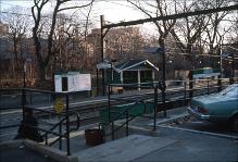
| dc.description | general view, Longwood Green Line Station, 1987 | en_US |
| dc.relation.ispartof | 141534 | en_US |
| dc.rights | (c) Massachusetts Institute of Technology, photograph by Julie Johnson | en_US |
| dc.subject | Suburbs | en_US |
| dc.subject | Massachusetts | en_US |
| dc.subject | Urban areas | en_US |
| dc.subject | Land use, Urban | en_US |
| dc.subject | City planning | en_US |
| dc.subject | Brookline (Mass.) | en_US |
| dc.subject | Cities and towns -- United States | en_US |
| dc.subject | Railroad stations | en_US |
| dc.subject | Transportation | en_US |
| dc.subject | Massachusetts Bay Transportation Authority | en_US |
| dc.subject | Boston Suburbs - Chapter 2 - 1865-1910 | en_US |
| dc.title | Town of Brookline | en_US |
| dc.type | Image | en_US |
| dc.rights.access | Creative Commons Attribution-NonCommercial 3.0 http://creativecommons.org/licenses/by-nc/3.0/ | en_US |
| dc.identifier.vendorcode | 2.96 | en_US |
| vra.culturalContext | American | en_US |
| vra.worktype | Town | en_US |
| dc.contributor.display | unknown (American) | en_US |


