| dc.creator | G.W. Bromley & Co. | en_US |
| dc.date.accessioned | 2010-02-04T15:23:30Z | |
| dc.date.available | 2010-02-04T15:23:30Z | |
| dc.identifier | 139528 | en_US |
| dc.identifier.uri | http://hdl.handle.net/1721.3/48720 | en_US |
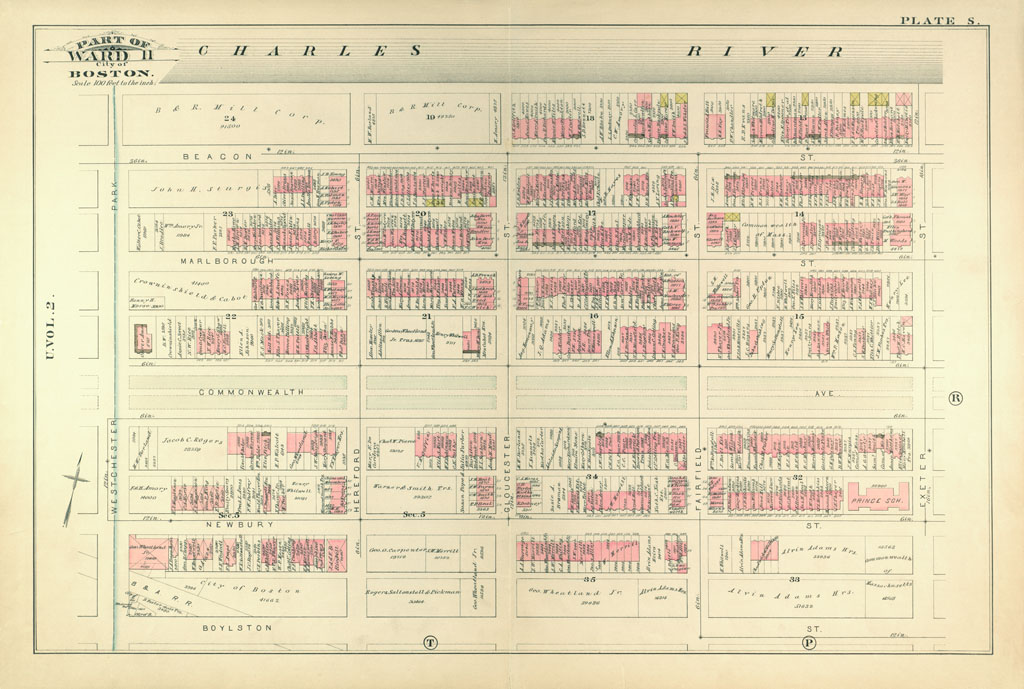
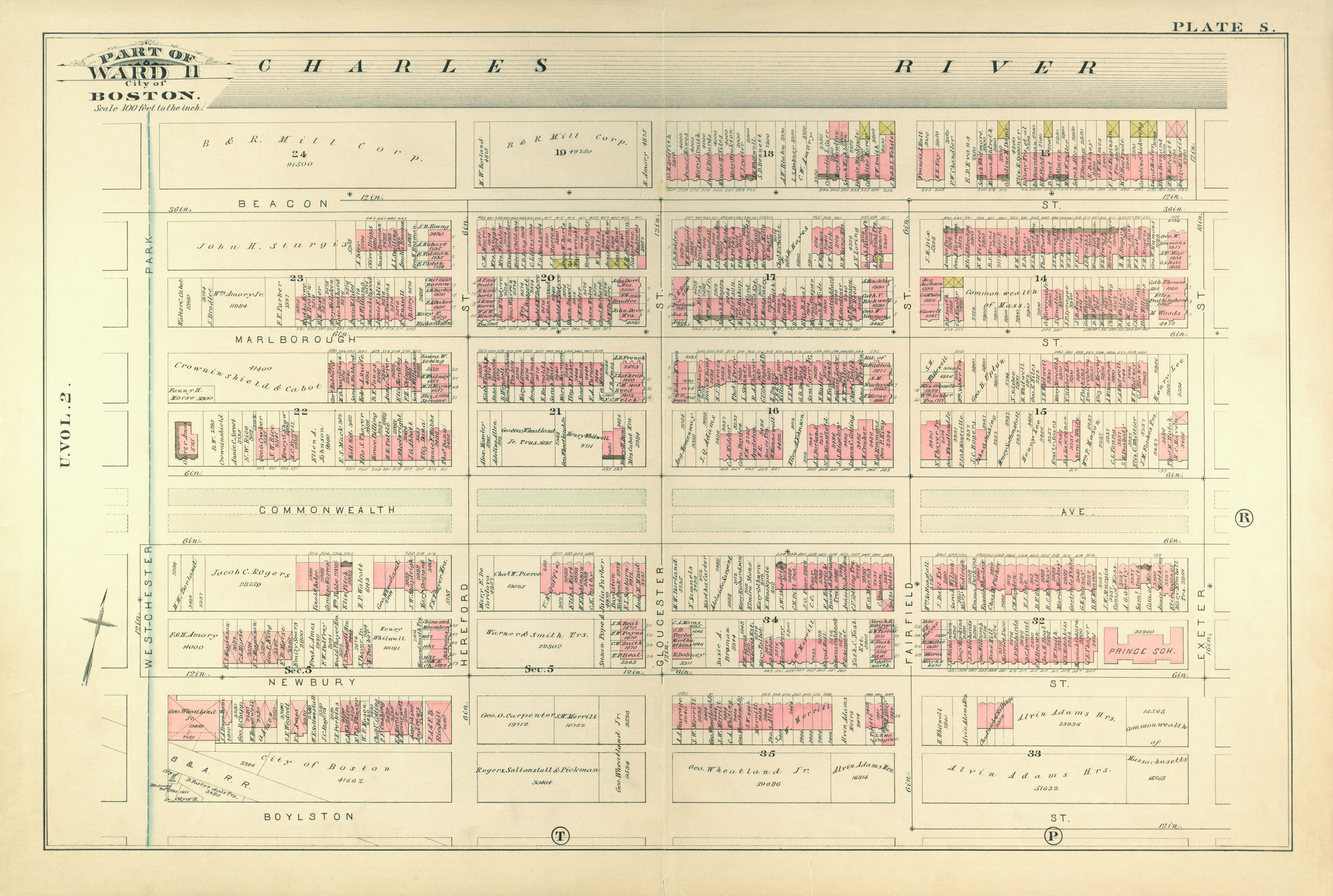
| dc.description | page, Plate S: part of ward 11; scale 100 feet per inch; Back Bay, Commonwealth Avenue | en_US |
| dc.format.medium | paper (fiber product) | en_US |
| dc.format.medium | ink | en_US |
| dc.relation.ispartof | 138996 | en_US |
| dc.subject | Cartography | en_US |
| dc.subject | Urban planning | en_US |
| dc.subject | Boston (Mass.) | en_US |
| dc.subject | Atlases | en_US |
| dc.subject | United States -- Maps | en_US |
| dc.subject | Fire insurance maps | en_US |
| dc.subject | Historical geography --Maps | en_US |
| dc.subject | City planning | en_US |
| dc.subject | Back Bay (Boston, Mass.) | en_US |
| dc.subject | Charles River (Mass.) | en_US |
| dc.subject | Commonwealth Ave. (Boston, MA) | en_US |
| dc.title | Atlas of the City of Boston, from Actual Surveys and Official Records; City
Proper, Volume 1 (1883) | en_US |
| dc.type | Image | en_US |
| dc.publisher.institution | Repository: Rotch Library, Massachusetts Institute of Technology (Cambridge,
Massachusetts, United States) | en_US |
| vra.culturalContext | American | en_US |
| vra.technique | printing | en_US |
| vra.worktype | Atlas | en_US |
| dc.contributor.display | civil engineers: G.W. Bromley & Co. (American, founded late 19th
century) | en_US |