MIT Libraries logoDome

MIT
View Item 
  • Dome Home
  • Visual Collections
  • Atlases of the City of Boston, G.W. Bromley & Co., 1883 & 1902
  • View Item
  • Dome Home
  • Visual Collections
  • Atlases of the City of Boston, G.W. Bromley & Co., 1883 & 1902
  • View Item
JavaScript is disabled for your browser. Some features of this site may not work without it.

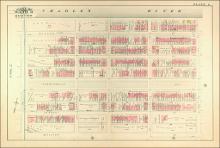
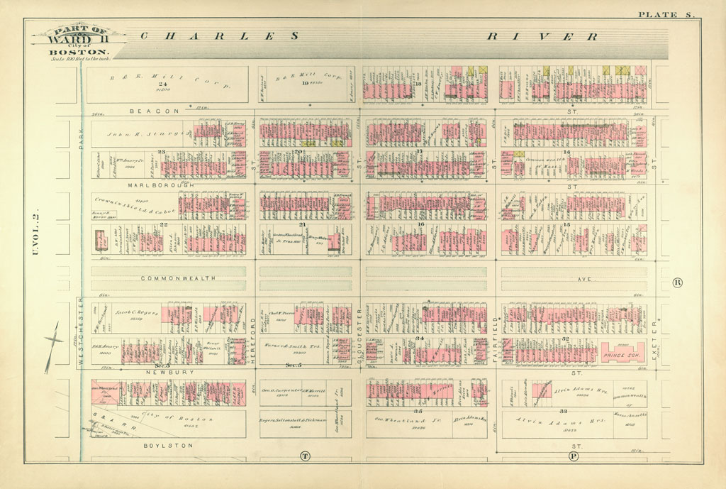
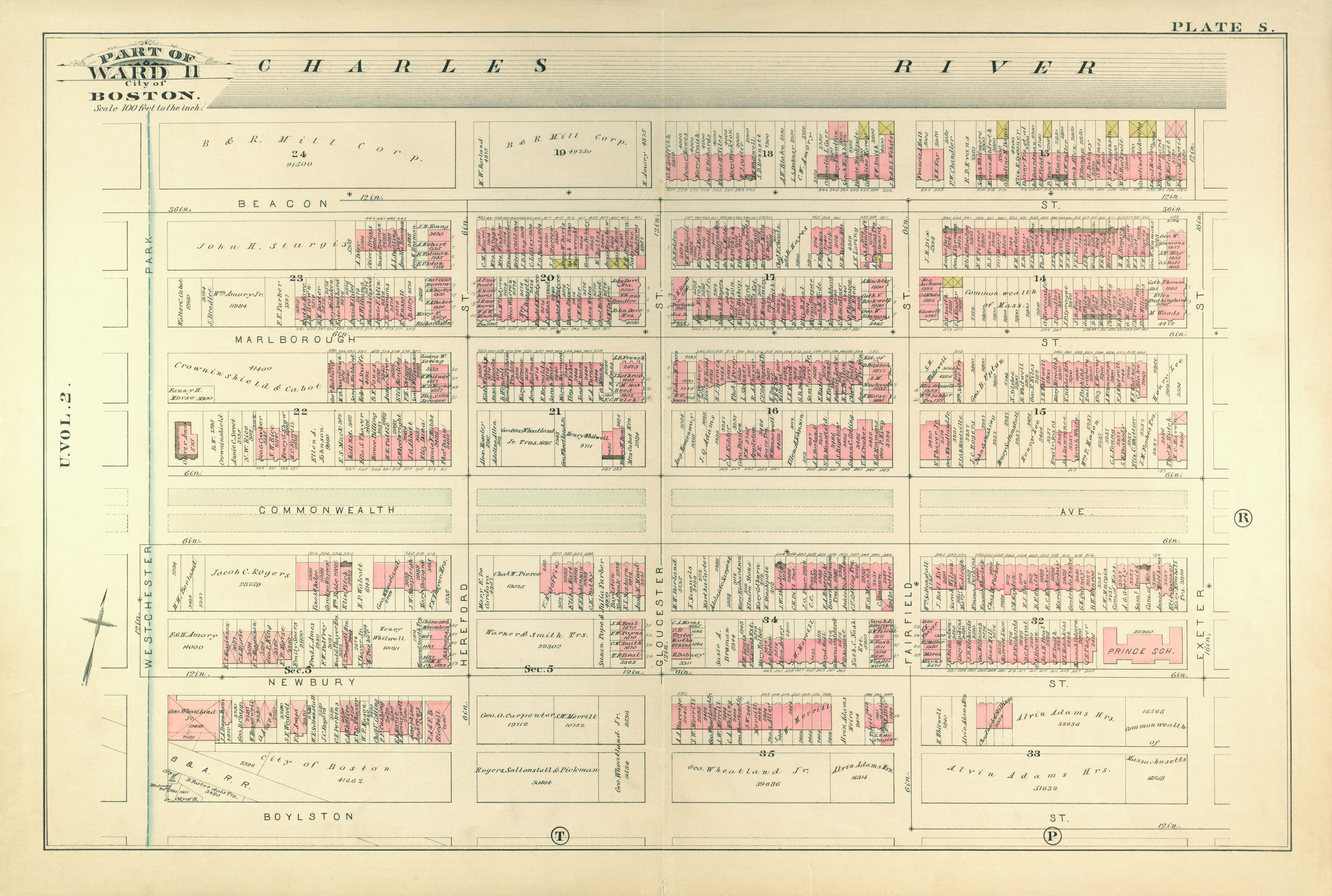
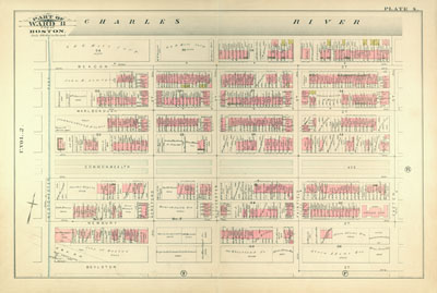
Atlas of the City of Boston, from Actual Surveys and Official Records; City Proper, Volume 1 (1883)

G.W. Bromley & Co.
Thumbnail
Download139528_cp.jpg (199.7Kb)
Alternate file
139528_sv.jpg (1.098Mb)
139528_tm.jpg (50.22Kb)
URI
http://hdl.handle.net/1721.3/48720
Description
page, Plate S: part of ward 11; scale 100 feet per inch; Back Bay, Commonwealth Avenue
Type of Work
Atlas
Subject
Cartography, Urban planning, Boston (Mass.), Atlases, United States -- Maps, Fire insurance maps, Historical geography --Maps, City planning, Back Bay (Boston, Mass.), Charles River (Mass.), Commonwealth Ave. (Boston, MA)
Item is Part of
138996
Metadata
Show full item record

Collections
  • Atlases of the City of Boston, G.W. Bromley & Co., 1883 & 1902

Browse

All of DomeCommunities & CollectionsBy Issue DateCreatorsTitlesSubjectsThis CollectionBy Issue DateCreatorsTitlesSubjects

My Account

Login
MIT Libraries
PrivacyPermissionsAccessibilityContact us
MIT
Content created by the MIT Libraries, CC BY-NC unless otherwise noted. Notify us about copyright concerns.