| dc.coverage.temporal | creation date: field work finished, September 1914, publication date: 1915 | en_US |
| dc.creator | Munn, Leonard | en_US |
| dc.date | September 1914 | en_US |
| dc.date.accessioned | 2009-11-17T19:00:28Z | |
| dc.date.available | 2009-11-17T19:00:28Z | |
| dc.date.issued | 1914 | en_US |
| dc.identifier | 113041 | en_US |
| dc.identifier.uri | http://hdl.handle.net/1721.3/45419 | en_US |
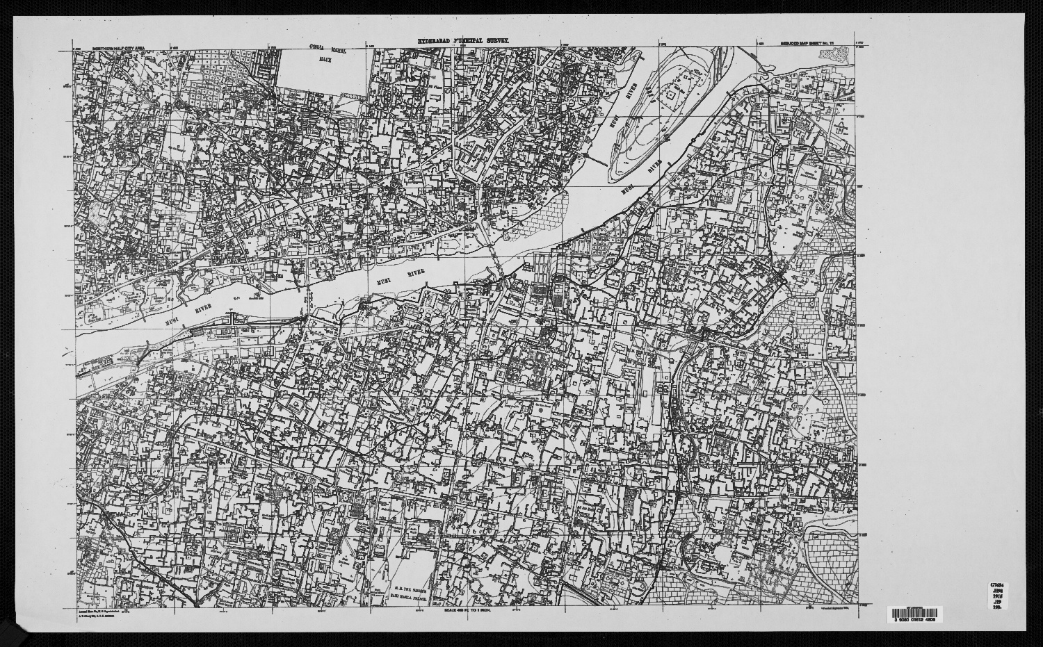
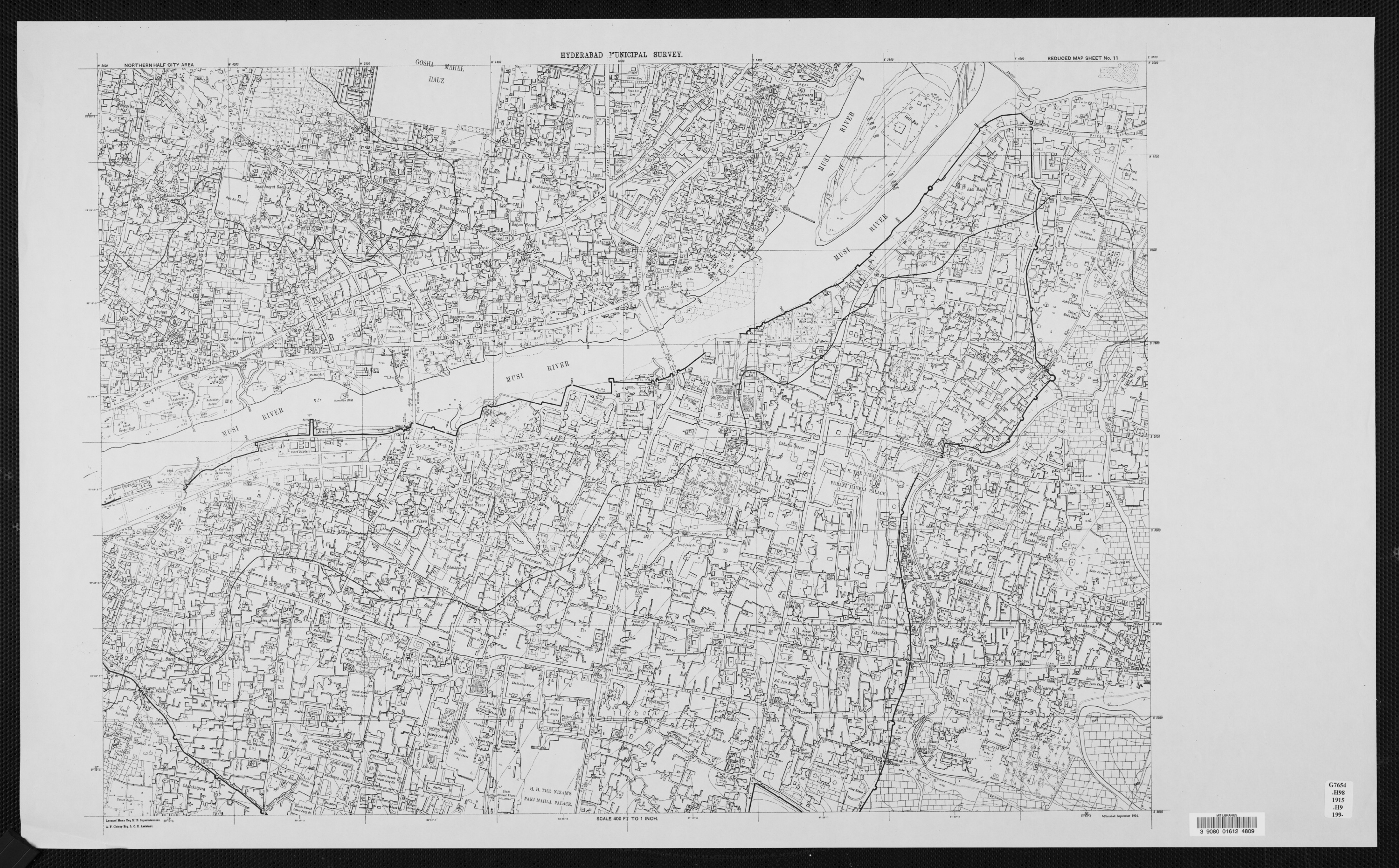
| dc.description | full view, H.H. The Nizam's Panj Mahla Palace; Musi River; Deorhi Nawab Khurshed Jah;
Deorhi Nawab Asman Jah; Makka Masjid; Mahbub Chauk Clock Tower; Mir Alam Mandi; H.H. The
Nizam's Purani Haveli Palace and Gosha Mahal Hauz visible | en_US |
| dc.format.medium | paper (fiber product) | en_US |
| dc.format.medium | ink | en_US |
| dc.relation.ispartof | 131752 | en_US |
| dc.subject | Cartography | en_US |
| dc.subject | Maps | en_US |
| dc.subject | Urban planning | en_US |
| dc.subject | Islamic cities and towns | en_US |
| dc.subject | Architecture, Islamic --India | en_US |
| dc.subject | Surveys | en_US |
| dc.subject | Historical geography --Maps | en_US |
| dc.subject | Hyderabad (India) | en_US |
| dc.title | Reduced Map Sheet No. 11, Northern Half City Area | en_US |
| dc.type | Image | en_US |
| dc.identifier.vendorcode | 39080016124809 | en_US |
| dc.publisher.institution | Repository: Rotch Library, Massachusetts Institute of Technology (Cambridge,
Massachusetts, United States) | en_US |
| vra.culturalContext | Indian (South Asian) | en_US |
| vra.technique | cartography | en_US |
| vra.technique | surveying | en_US |
| vra.worktype | Map | en_US |
| dc.contributor.display | surveyor: Leonard Munn (English, 1878-1935) | en_US |