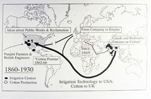
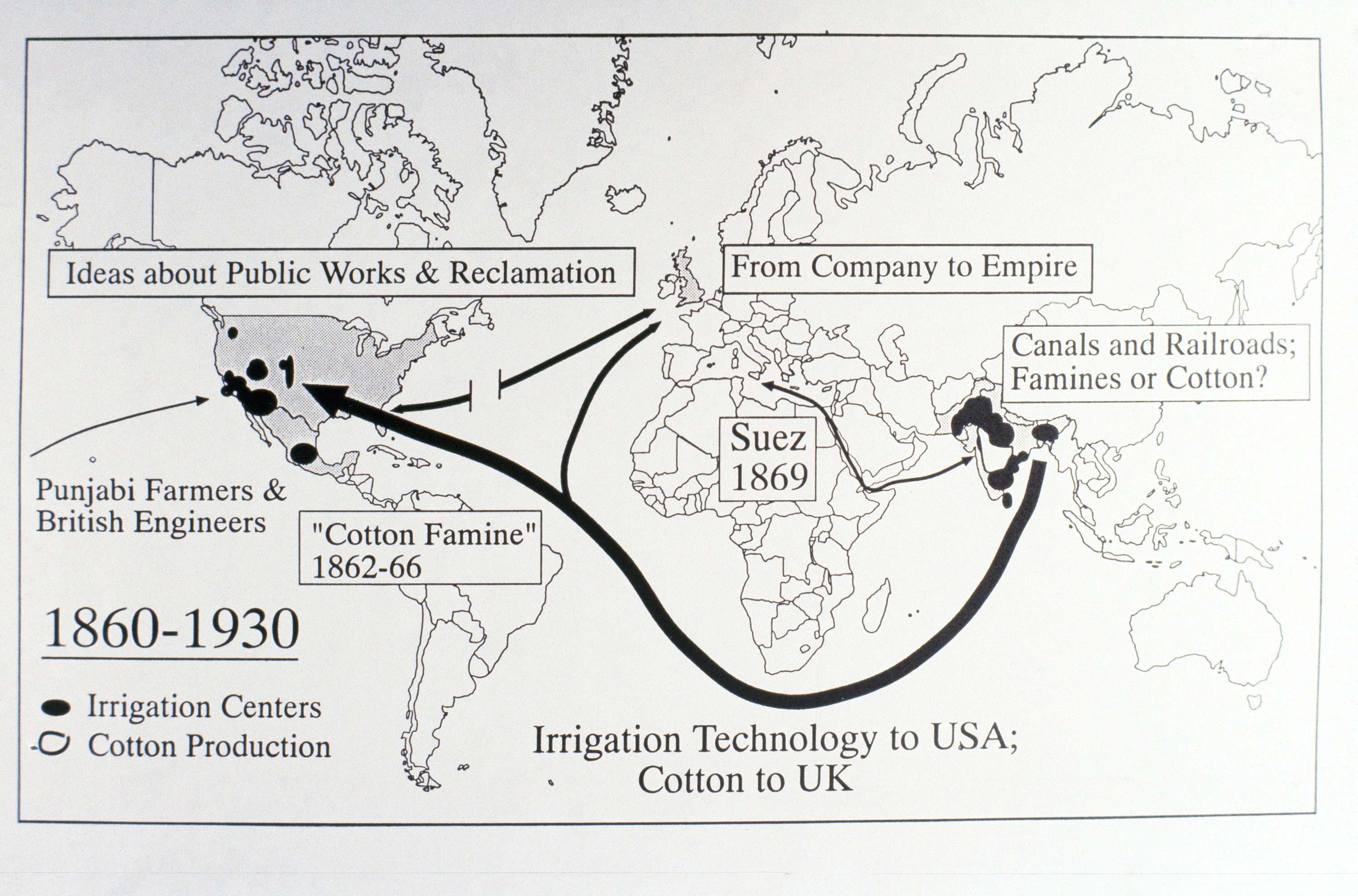
World Map Showing Irrigation Centers
Download122114_cp.jpg (519.8Kb)
Date
1900-1999Description
full view, 1860-1930, irrigation centers and cotton production
Type of Work
MapSubject
United States -- Maps, World maps, Irrigation systems, Trade routes, Water-supply, International trade, India -- Maps, Cotton industry
Rights
Rights Statement
All rights reserved
Item is Part of
137346