MIT Libraries logoDome

MIT
View Item 
  • Dome Home
  • Perceptual Form of the City
  • Perceptual Form of the City
  • View Item
  • Dome Home
  • Perceptual Form of the City
  • Perceptual Form of the City
  • View Item
JavaScript is disabled for your browser. Some features of this site may not work without it.

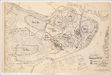
Map of City Proper (districts)

Lynch, Kevin (American, 1918-1984), researcher
Thumbnail
DownloadKL_002188_cp.jpg (745.1Kb)
Alternate file
KL_002188_sv.jpg (5.504Mb)
URI
http://hdl.handle.net/1721.3/36514
Date
1959
Description
Hand-drawn districts demarcated on "Map of City Proper" (Boston: City Planning Board, January, 1953). Documentation created as part of the Perceptual Form of the City, a research project investigating the individual’s perception of the urban landscape.
Item is Part of
MC 208, Box 6, Boston Image (1 of 3)
Metadata
Show full item record

Collections
  • Perceptual Form of the City

Browse

All of DomeCommunities & CollectionsBy Issue DateCreatorsTitlesSubjectsThis CollectionBy Issue DateCreatorsTitlesSubjects

My Account

Login
MIT Libraries
PrivacyPermissionsAccessibilityContact us
MIT
Content created by the MIT Libraries, CC BY-NC unless otherwise noted. Notify us about copyright concerns.