| dc.creator | Lynch, Kevin (American, 1918-1984), professor | en_US |
| dc.date.accessioned | 2009-03-03T03:24:37Z | |
| dc.date.available | 2009-03-03T03:24:37Z | |
| dc.date.created | 02/1960 | en_US |
| dc.date.issued | 1960 | en_US |
| dc.identifier | 125942 | en_US |
| dc.identifier.other | MC 208 | en_US |
| dc.identifier.uri | http://hdl.handle.net/1721.3/36511 | |
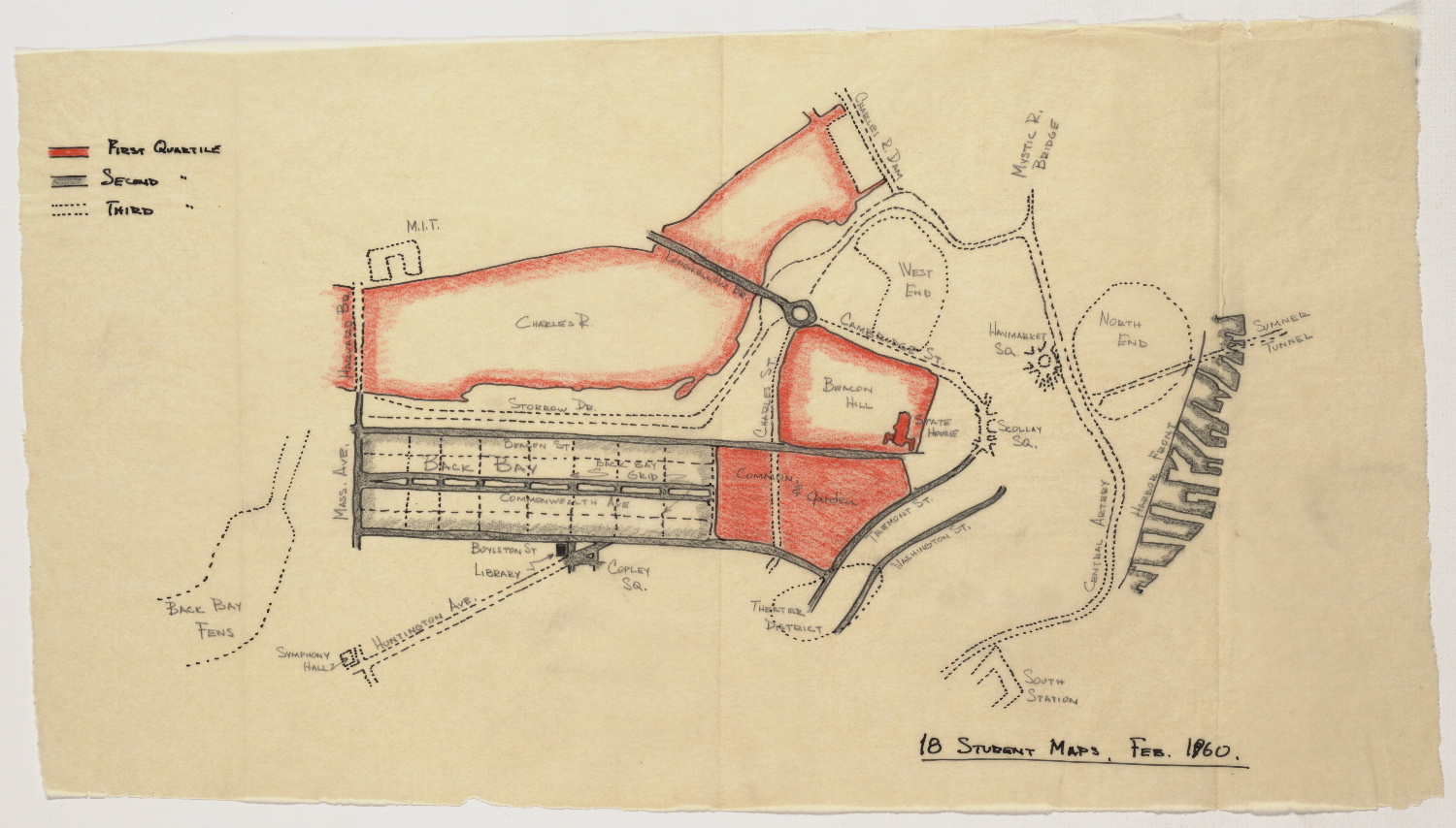
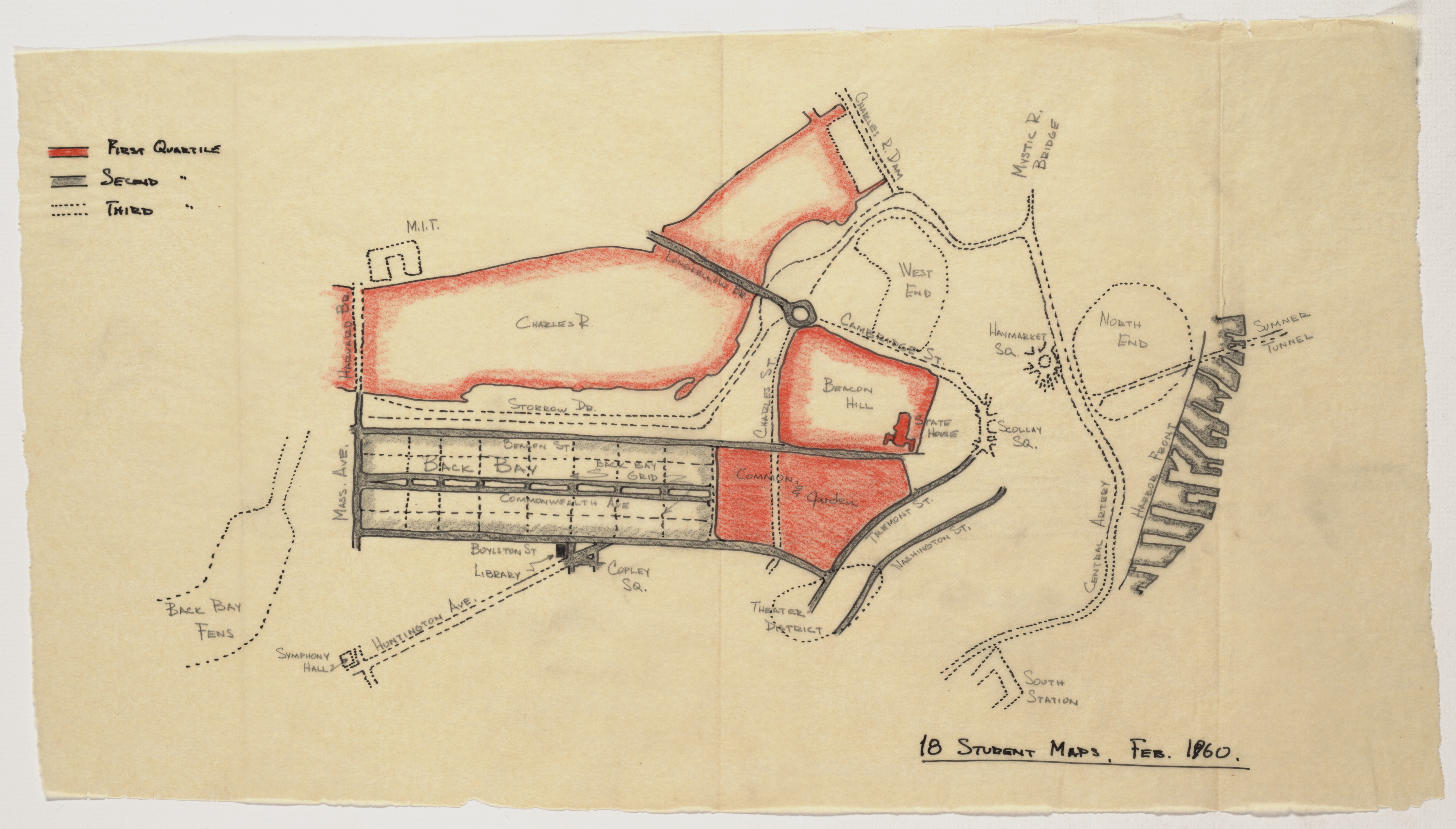
| dc.description | A visual representation of the number of times specific Boston areas were noted on student drawn maps. Drawn for the Perceptual Form of the City, a research project investigating the individual’s perception of the urban landscape. | en_US |
| dc.format.extent | Dimensions: 20.2 x 11.2 in | en_US |
| dc.publisher | Massachusetts Institute of Technology, Institute Archives and Special Collections | en_US |
| dc.relation.ispartof | MC 208, Box 6, Early Interviews & Student Maps | en_US |
| dc.relation.isbasedon | KL_002182 | en_US |
| dc.subject.lcsh | Boston (Mass.) | en_US |
| dc.subject.lcsh | Urban planning and environment | en_US |
| dc.subject.lcsh | Kepes, Gyorgy, 1906-2001 | en_US |
| dc.subject.lcsh | Lynch, Kevin, 1918-1984 | en_US |
| dc.subject.other | Early Interviews & Student Maps | en_US |
| dc.subject.other | Kevin Lynch Papers, MC 208 | en_US |
| dc.title | 18 Student maps | en_US |
| dc.type | Drawing | en_US |
| dc.rights.copyright | (c) Unpublished manuscripts are protected by copyright. Permission to publish,
quote, or reproduce must be secured from the Institute Archives and Special
Collections and the copyright holder. | en_US |