| dc.creator | Lynch, Kevin (American, 1918-1984), author | en_US |
| dc.date.accessioned | 2009-02-20T00:06:28Z | |
| dc.date.available | 2009-02-20T00:06:28Z | |
| dc.date.created | 1954-1959 | en_US |
| dc.date.issued | 1959 | en_US |
| dc.identifier | 125843 | en_US |
| dc.identifier.other | MC 208 | en_US |
| dc.identifier.uri | http://hdl.handle.net/1721.3/35653 | |
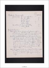
| dc.description | Numeric data representing landmarks, districts, nodes, and paths named during
interviews and in diagrams drawn by study participants. Data collected as part of
the Perceptual Form of the City, a research project investigating the individual’s
perception of the urban landscape. | en_US |
| dc.format.extent | Count of pages: 9 | en_US |
| dc.publisher | Massachusetts Institute of Technology, Institute Archives and Special Collections | en_US |
| dc.relation.ispartof | MC 208, Box 2, Boston Image (2 of 3) | en_US |
| dc.relation.isbasedon | KL_002082 | en_US |
| dc.subject.lcsh | Boston (Mass.) | en_US |
| dc.subject.lcsh | Urban planning and environment | en_US |
| dc.subject.lcsh | Kepes, Gyorgy, 1906-2001 | en_US |
| dc.subject.lcsh | Lynch, Kevin, 1918-1984 | en_US |
| dc.subject.other | Districts | en_US |
| dc.subject.other | Boston Image (2 of 3) | en_US |
| dc.subject.other | Kevin Lynch Papers, MC 208 | en_US |
| dc.subject.other | Nodes | en_US |
| dc.subject.other | Landmarks | en_US |
| dc.subject.other | Path | en_US |
| dc.subject.other | Areas | en_US |
| dc.title | Check on drawn maps and general conclusions | en_US |
| dc.type | Field notes | en_US |
| dc.rights.copyright | (c) Unpublished manuscripts are protected by copyright. Permission to publish,
quote, or reproduce must be secured from the Institute Archives and Special
Collections and the copyright holder. | en_US |