Browsing Perceptual Form of the City by Title
Now showing items 879-898 of 2194
-
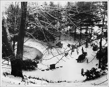
Gravestones and Burial Vault Alongside Pond, in Snow
(Repository: Rotch Visual Collections, Massachusetts Institute of Technology (Cambridge, Massachusetts, United States) ID: Kepes/Lynch Collection, 54.65, 1954-1959) -
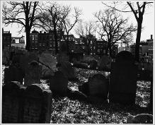
Gravestones, Copp's Hill Burying Ground, Facing West, in Snow
(Repository: Rotch Visual Collections, Massachusetts Institute of Technology (Cambridge, Massachusetts, United States) ID: Kepes/Lynch Collection, 54.56, 1954-1959) -
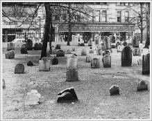
Gravestones, Granary Burying Ground, Facing Tremont Street, Woolworth Store in Background
(Repository: Rotch Visual Collections, Massachusetts Institute of Technology (Cambridge, Massachusetts, United States) ID: Kepes/Lynch Collection, 54.74, 1954-1959) -
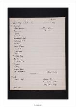
Greer Base Map (Interview) and Drawn Map
(Massachusetts Institute of Technology, Institute Archives and Special Collections, 2009-02-20) -
Grid Series, Taken from Intersecting Points of Map, Albany Street, 2:10 P.M.
(Repository: Rotch Visual Collections, Massachusetts Institute of Technology (Cambridge, Massachusetts, United States) ID: Kepes/Lynch Collection, 51.27, 1954-1959) -
Grid Series, Taken from Intersecting Points of Map, Albany Street, Facing North, 2:30 P.M.
(Repository: Rotch Visual Collections, Massachusetts Institute of Technology (Cambridge, Massachusetts, United States) ID: Kepes/Lynch Collection, 51.39, 1954-1959) -
Grid Series, Taken from Intersecting Points of Map, Albany Street, Facing Northeast
(Repository: Rotch Visual Collections, Massachusetts Institute of Technology (Cambridge, Massachusetts, United States) ID: Kepes/Lynch Collection, 51.55, 1956) -
Grid Series, Taken from Intersecting Points of Map, Arlington Street approaching Commonwealth Avenue, Sidewalk, Public Garden at Right
(Repository: Rotch Visual Collections, Massachusetts Institute of Technology (Cambridge, Massachusetts, United States) ID: Kepes/Lynch Collection, 51.44a, 1954-1959) -
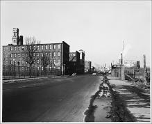
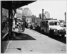
Grid Series, Taken from Intersecting Points of Map, Atlantic Avenue, South Station, 12:45 P.M.
(Repository: Rotch Visual Collections, Massachusetts Institute of Technology (Cambridge, Massachusetts, United States) ID: Kepes/Lynch Collection, 51.16, 1954-1959) -
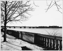
Grid Series, Taken from Intersecting Points of Map, Bank of Charles River, Boston Side
(Repository: Rotch Visual Collections, Massachusetts Institute of Technology (Cambridge, Massachusetts, United States) ID: Kepes/Lynch Collection, 51.28, 1956) -
Grid Series, Taken from Intersecting Points of Map, Base of Longfellow Bridge, 3:45 P.M.
(Repository: Rotch Visual Collections, Massachusetts Institute of Technology (Cambridge, Massachusetts, United States) ID: Kepes/Lynch Collection, 51.36, 1954-1959) -
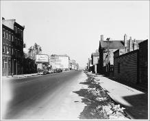
Grid Series, Taken from Intersecting Points of Map, Battery Street at Atlantic Avenue, Facing West, 10:15 A.M.
(Repository: Rotch Visual Collections, Massachusetts Institute of Technology (Cambridge, Massachusetts, United States) ID: Kepes/Lynch Collection, 51.06, 1954-1959) -
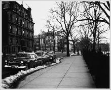
Grid Series, Taken from Intersecting Points of Map, Beacon Street, Bellevue Hotel at Right
(Repository: Rotch Visual Collections, Massachusetts Institute of Technology (Cambridge, Massachusetts, United States) ID: Kepes/Lynch Collection, 51.33, 1954-1959) -
Grid Series, Taken from Intersecting Points of Map, Broadway near Stuart Street, Music Bar at Right
(Repository: Rotch Visual Collections, Massachusetts Institute of Technology (Cambridge, Massachusetts, United States) ID: Kepes/Lynch Collection, 51.38, 1954-1959) -
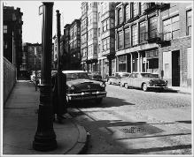
Grid Series, Taken From Intersecting Points of Map, Cambridge Street, Facing West
(Repository: Rotch Visual Collections, Massachusetts Institute of Technology (Cambridge, Massachusetts, United States) ID: Kepes/Lynch Collection, 51.53, 1956) -
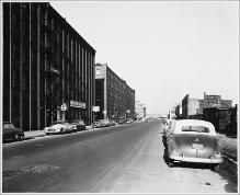
Grid Series, Taken from Intersecting Points of Map, Central Artery, Causeway Street, Facing Elevated Rail, 11:30 A.M.
(Repository: Rotch Visual Collections, Massachusetts Institute of Technology (Cambridge, Massachusetts, United States) ID: Kepes/Lynch Collection, 51.03, 1954-1959) -
Grid Series, Taken from Intersecting Points of Map, Charles River Embankment and Esplanade, Facing North towards Longfellow Bridge
(Repository: Rotch Visual Collections, Massachusetts Institute of Technology (Cambridge, Massachusetts, United States) ID: Kepes/Lynch Collection, 51.30, 1954-1959) -
Grid Series, Taken from Intersecting Points of Map, Charles River Embankment and Music Oval
(Repository: Rotch Visual Collections, Massachusetts Institute of Technology (Cambridge, Massachusetts, United States) ID: Kepes/Lynch Collection, 51.42, 1954-1959) -
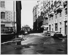
Grid Series, Taken from Intersecting Points of Map, Charles River Embankment Road
(Repository: Rotch Visual Collections, Massachusetts Institute of Technology (Cambridge, Massachusetts, United States) ID: Kepes/Lynch Collection, 51.34, 1954-1959) -
Grid Series, Taken from Intersecting Points of Map, Charles River Embankment Road, Facing North
(Repository: Rotch Visual Collections, Massachusetts Institute of Technology (Cambridge, Massachusetts, United States) ID: Kepes/Lynch Collection, 51.29, 1954-1959)