MIT Libraries logoDome

MIT
View Item 
  • Dome Home
  • Visual Collections
  • Aga Khan Visual Archive
  • View Item
  • Dome Home
  • Visual Collections
  • Aga Khan Visual Archive
  • View Item
JavaScript is disabled for your browser. Some features of this site may not work without it.

The Mughal Empire: Politcal 1601

Unknown
Thumbnail
Download121742_cp.jpg (635.9Kb)
Alternate file
121742_sv.jpg (2.653Mb)
121742_tm.jpg (22.68Kb)
121742.tif (59.91Mb)
URI
http://hdl.handle.net/1721.3/33648
Description
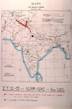
map, Regnal Year 12-15 - 1638-1642 - No 'Urs
Type of Work
Map
Subject
Islamic cities and towns, Mogul Empire, Historical geography --Maps, Southeast Asia, India -- Maps, Shahjahan, Emperor of India, ca. 1592-1666
Rights
(c) James Wescoat
Rights Statement
All rights reserved
Item is Part of
137262
Metadata
Show full item record

Collections
  • Aga Khan Visual Archive

Browse

All of DomeCommunities & CollectionsBy Issue DateCreatorsTitlesSubjectsThis CollectionBy Issue DateCreatorsTitlesSubjects

My Account

Login
MIT Libraries
PrivacyPermissionsAccessibilityContact us
MIT
Content created by the MIT Libraries, CC BY-NC unless otherwise noted. Notify us about copyright concerns.