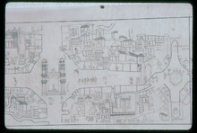
Urban Conservation Study, Map of Hyderabad City
Hyderabad Urban Development Authority

Download112290_cp.jpg (310.6Kb)
Date
1772Description
map, section of sheet 1, showing the lay out of the neighborhoods with Charminar in the center left, 1986
Type of Work
MapSubject
Cartography, Conservation, Islamic cities and towns, Architecture, Islamic --India, Historical geography --Maps, Urban planning and environment, Hyderabad (India), Deccan (India)
Rights
Rights Statement
All rights reserved
Item is Part of
131501