MIT Libraries logoDome

MIT
View Item 
  • Dome Home
  • Visual Collections
  • Architecture in Hyderabad, India
  • View Item
  • Dome Home
  • Visual Collections
  • Architecture in Hyderabad, India
  • View Item
JavaScript is disabled for your browser. Some features of this site may not work without it.

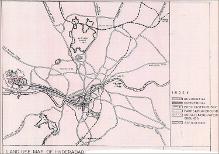
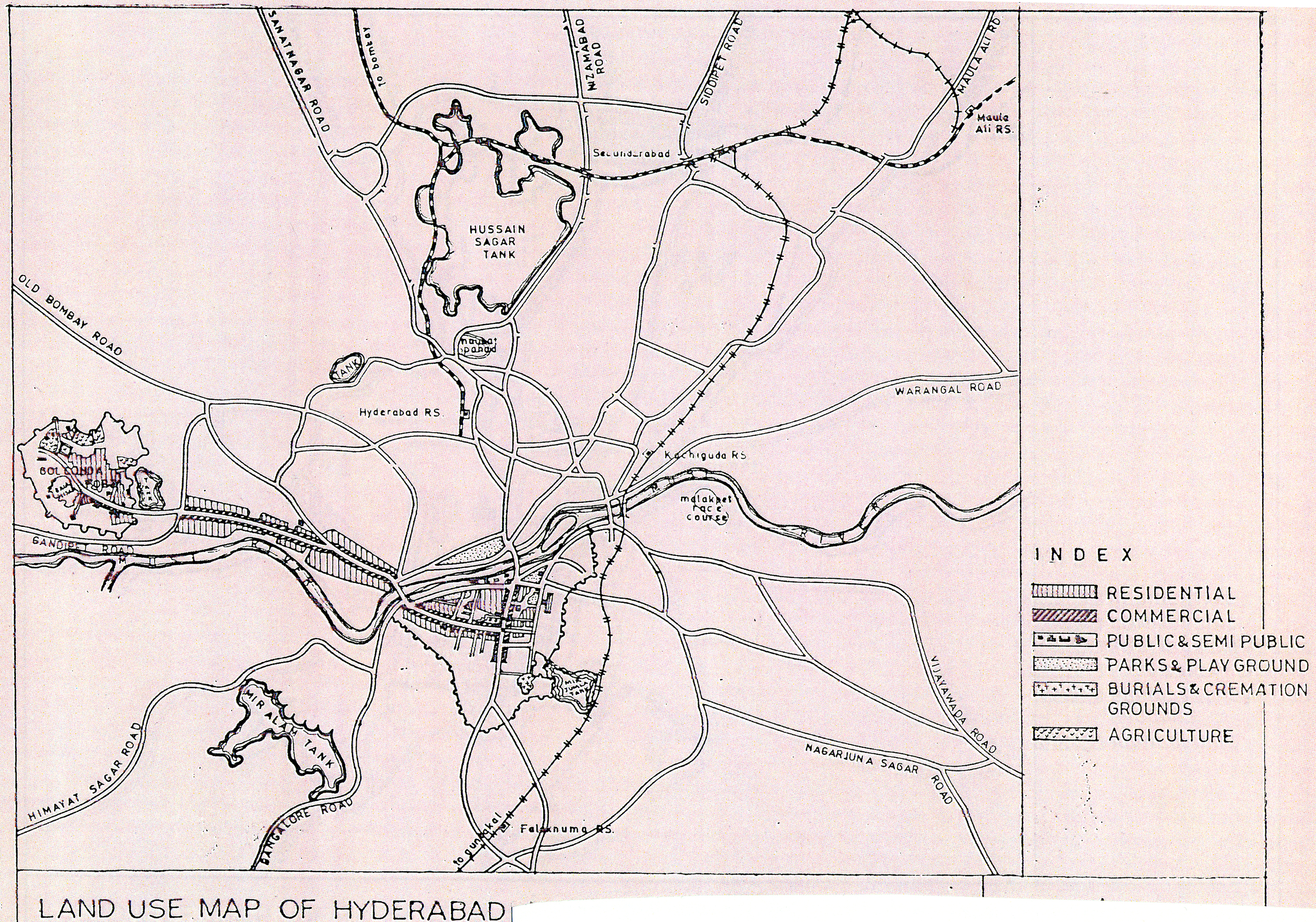
Land Use Map of Hyderabad in 1612

City Improvement Board
Thumbnail
Download109536_cp.jpg (2.282Mb)
Alternate file
109536_sv.jpg (10.64Mb)
109536_tm.jpg (37.29Kb)
URI
http://hdl.handle.net/1721.3/20145
Description
full view, showing agricultural, residential, commercial, public and semi-public lands, parks and public grounds as well as burial and cremation grounds.
Type of Work
Map
Subject
Cartography, India, Mughal, Islamic cities and towns, Historical geography --Maps, Land use, Urban, Hyderabad (India)
Rights Statement
All rights reserved
Item is Part of
130034
Metadata
Show full item record

Collections
  • Architecture in Hyderabad, India

Browse

All of DomeCommunities & CollectionsBy Issue DateCreatorsTitlesSubjectsThis CollectionBy Issue DateCreatorsTitlesSubjects

My Account

Login
MIT Libraries
PrivacyPermissionsAccessibilityContact us
MIT
Content created by the MIT Libraries, CC BY-NC unless otherwise noted. Notify us about copyright concerns.