| dc.coverage.temporal | creation date: surveyed, 1912-1915, publication date: 1915 | en_US |
| dc.creator | Munn, Leonard | en_US |
| dc.date | 1912-1915 | en_US |
| dc.date.accessioned | 2007-08-21T19:03:01Z | |
| dc.date.available | 2007-08-21T19:03:01Z | |
| dc.date.issued | 1912-1915 | en_US |
| dc.identifier | 111545 | en_US |
| dc.identifier.uri | http://hdl.handle.net/1721.3/20141 | en_US |
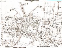
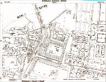
| dc.description | map, Sheet 25, with Musi River, Afzal Ganj Bridge, Char Minar Road, & Chhatta Bazar Street visible, 1915 | en_US |
| dc.format.medium | paper (fiber product) | en_US |
| dc.format.medium | ink | en_US |
| dc.relation.ispartof | 130722 | en_US |
| dc.subject | Cartography | en_US |
| dc.subject | Maps | en_US |
| dc.subject | Urban planning | en_US |
| dc.subject | Islamic cities and towns | en_US |
| dc.subject | Architecture, Islamic --India | en_US |
| dc.subject | Surveys | en_US |
| dc.subject | Historical geography --Maps | en_US |
| dc.subject | Hyderabad (India) | en_US |
| dc.title | Hyderabad Municipal Survey | en_US |
| dc.type | Image | en_US |
| dc.rights.access | All rights reserved | en_US |
| vra.culturalContext | Indian (South Asian) | en_US |
| vra.technique | cartography | en_US |
| vra.technique | surveying | en_US |
| vra.worktype | Map | en_US |
| vra.worktype | Land survey | en_US |
| dc.contributor.display | surveyor: Leonard Munn (English, 1878-1935) | en_US |


