| dc.coverage.spatial | Creation location: Hyderabad (Andhra Pradesh, India) | en_US |
| dc.creator | Mohiuddin, Ghulam Hasan | en_US |
| dc.date.accessioned | 2007-08-21T19:01:48Z | |
| dc.date.available | 2007-08-21T19:01:48Z | |
| dc.identifier | 109531 | en_US |
| dc.identifier.uri | http://hdl.handle.net/1721.3/20132 | en_US |
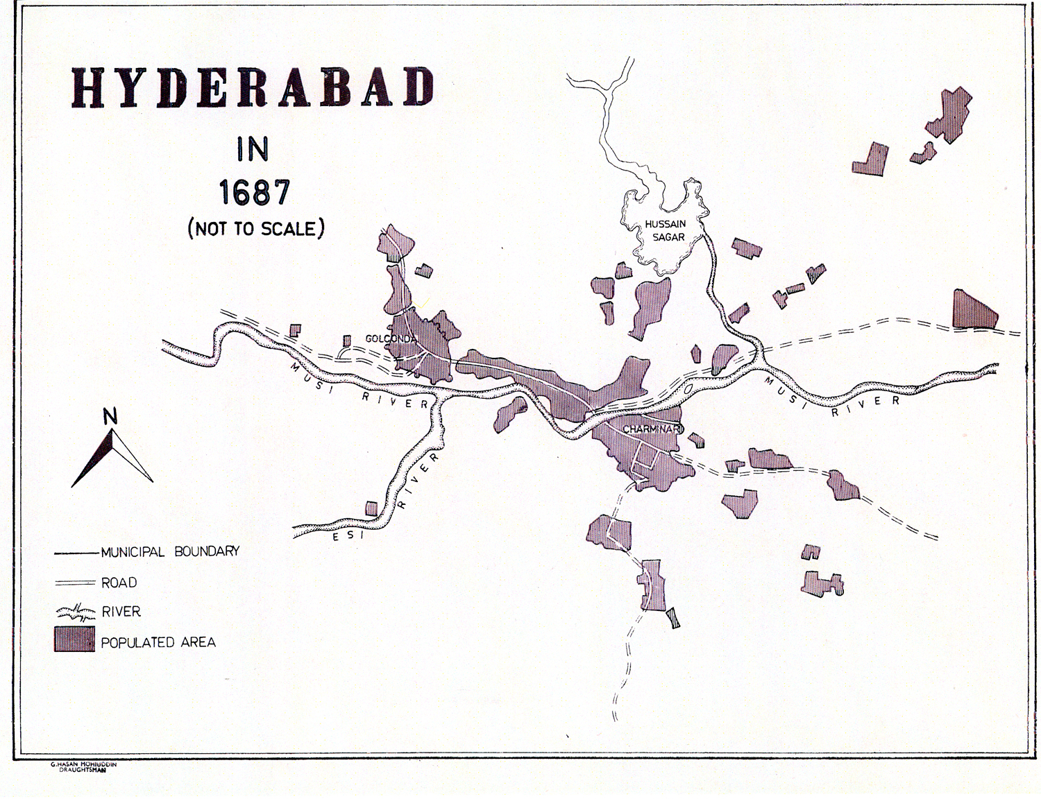
| dc.description | full view, showing the municipal boundary, roads, river Musi and the populated area | en_US |
| dc.format.medium | paper (fiber product) | en_US |
| dc.format.medium | ink | en_US |
| dc.relation.ispartof | 130019 | en_US |
| dc.rights | (c) Ghulam Hasan Mohiuddin | en_US |
| dc.subject | Cartography | en_US |
| dc.subject | India | en_US |
| dc.subject | Mughal | en_US |
| dc.subject | Islamic cities and towns | en_US |
| dc.subject | Historical geography --Maps | en_US |
| dc.subject | Population | en_US |
| dc.subject | Land use, Urban | en_US |
| dc.subject | Hyderabad (India) | en_US |
| dc.title | Hyderabad in 1687 | en_US |
| dc.type | Image | en_US |
| dc.rights.access | All rights reserved | en_US |
| vra.culturalContext | Indian (South Asian) | en_US |
| vra.technique | cartography | en_US |
| vra.worktype | Map | en_US |
| dc.contributor.display | cartographer: Ghulam Hasan Mohiuddin (Indian (South Asian), ca. 1900-1960s) | en_US |