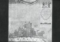
| dc.creator | Folie, A. P. | en_US |
| dc.date.accessioned | 2007-03-15T20:55:58Z | |
| dc.date.available | 2007-03-15T20:55:58Z | |
| dc.identifier | 105636 | en_US |
| dc.identifier.uri | http://hdl.handle.net/1721.3/17107 | en_US |
| dc.description | full view | en_US |
| dc.format.medium | paper (fiber product) | en_US |
| dc.format.medium | ink | en_US |
| dc.relation.ispartof | 129548 | en_US |
| dc.subject | Suburbs | en_US |
| dc.subject | Urban planning | en_US |
| dc.subject | Grids (layout features) | en_US |
| dc.subject | Plans (drawings) | en_US |
| dc.subject | Urbanization | en_US |
| dc.subject | Historical geography --Maps | en_US |
| dc.subject | Cities and towns --Growth | en_US |
| dc.subject | Land use, Urban | en_US |
| dc.subject | City planning | en_US |
| dc.subject | Drawing --18th century | en_US |
| dc.subject | Philadelphia (Pa.) | en_US |
| dc.title | Plan of the Cities and Suburbs of Philadelphia | en_US |
| dc.type | Image | en_US |
| dc.rights.access | All rights reserved | en_US |
| dc.publisher.institution | Repository: Library of Congress (Washington, District of Columbia, USA) | en_US |
| vra.culturalContext | American | en_US |
| vra.technique | drawing (image-making) | en_US |
| vra.technique | cartography | en_US |
| vra.worktype | Plan (map) | en_US |
| dc.contributor.display | draftsman: A. P. Folie (American, active late 18th century) | en_US |


