| dc.coverage.temporal | creation date: surveyed, 1997-1998, publication date: 6th edition, 2000 | en_US |
| dc.creator | Survey of Pakistan | en_US |
| dc.creator | Surveyor General of Pakistan | en_US |
| dc.date | 1997-1998 | en_US |
| dc.date.accessioned | 2014-05-28T15:55:22Z | |
| dc.date.available | 2014-05-28T15:55:22Z | |
| dc.date.issued | 1997-1998 | en_US |
| dc.identifier | 248077 | en_US |
| dc.identifier.uri | http://hdl.handle.net/1721.3/163297 | |
| dc.description | map | en_US |
| dc.format.extent | scale: 1:50,000 | en_US |
| dc.format.medium | paper (fiber product) | en_US |
| dc.format.medium | ink | en_US |
| dc.relation.ispartof | 144205 | en_US |
| dc.subject | Maps | en_US |
| dc.subject | Topographic maps | en_US |
| dc.subject | Pakistan -- Maps | en_US |
| dc.subject | Punjab (Pakistan) | en_US |
| dc.subject | Kasūr District (Pakistan) | en_US |
| dc.subject | Lahore District (Pakistan) | en_US |
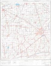
| dc.title | Punjab No. 44 I/8 Kasur & Lahore Districts | en_US |
| dc.type | Image | en_US |
| dc.rights.access | Licensed for educational and research use by the MIT community only | en_US |
| dc.identifier.vendorcode | 44I08 | en_US |
| vra.culturalContext | Pakistani | en_US |
| vra.technique | cartography | en_US |
| vra.worktype | Map | en_US |
| dc.contributor.display | Surveyor: Surveyor General of Pakistan (Pakistani, 1946-), Publisher: Survey of Pakistan (Pakistani, 1947-) | en_US |


