Pakistan Maps
Browse by
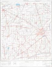
This collection contains two series of topographic maps of Pakistan: a series of Joint Operations Graphic maps at 1:250,000 scale published by the U.S. Government, and a collection of 1:50,000 scale maps published by the Survey of Pakistan. Most date to the 1980s-early 2000s.
These maps are licensed for educational and research use by the MIT community only.
Recent Submissions
-
Punjab No. 44 I/8 Kasur & Lahore Districts
(1997-1998) -
Punjab No. 44 I/7 Kasur & Lahore District
(1997-1998) -
Punjab No. 44 G/1 Bahawalnagar and Pakpattan Districts
(1996-1997) -
Punjab No. 44 F/13 Kasur & Okara Districts
(1999-2000) -
Punjab No. 44 F/8 Bahawalnagar and Pakpattan Districts
(1999-2000) -
Punjab No. 44 F/7 Bahawalnagar and Pakpattan Districts
(1999-2000) -
Punjab No. 44 F/4 Bahawalnagar and Pakpattan Districts
(1999-2000) -
Punjab No. 44 F/2 Pakpattan and Sahiwal Districts
(1999-2000) -
Punjab No. 44 E/16 Kasur & Shekhupura Districts
(2000-2001) -
Punjab No. 44 F/14 Seventh Edition Shekhupura District
(2000-2001) -
Punjab No. 44 F/4 Faisalabad District
(1999-2000) -
Punjab No. 44 F/3 Faisalabad District
(1999-2000) -
Punjab No. 44 F/2 Faisalabad and Jhang Districts
(1999-2000) -
Punjab No. 44 B/12 Sahiwal & Vihari Districts
(2001-2002)