| dc.coverage.spatial | Site: Boston (Massachusetts, United States) | en_US |
| dc.coverage.temporal | creation date: neighborhood of Roxbury until its annexation to Boston, 1868 | en_US |
| dc.creator | American | en_US |
| dc.date | 1868 | en_US |
| dc.date.accessioned | 2014-05-05T15:31:07Z | |
| dc.date.available | 2014-05-05T15:31:07Z | |
| dc.date.issued | 1868 | en_US |
| dc.identifier | 247684 | en_US |
| dc.identifier.uri | http://hdl.handle.net/1721.3/162859 | |
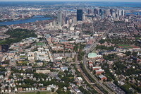
| dc.description | aerial view, looking northeast along Southeast Corridor, 9/14/2009 | en_US |
| dc.relation.ispartof | 144017 | en_US |
| dc.rights | © Alex S. MacLean / Landslides | en_US |
| dc.subject | Urban planning | en_US |
| dc.subject | Boston (Mass.) | en_US |
| dc.subject | Neighborhoods | en_US |
| dc.subject | Urban areas | en_US |
| dc.subject | Land use, Urban | en_US |
| dc.subject | City planning | en_US |
| dc.subject | National Register of Historic Places | en_US |
| dc.subject | Aerial views | en_US |
| dc.subject | Central business districts | en_US |
| dc.subject | Aerial photography --United States | en_US |
| dc.title | Mission Hill | en_US |
| dc.title.alternative | Parker HIll | en_US |
| dc.type | Image | en_US |
| dc.rights.access | Licensed for educational and research use by the MIT community only | en_US |
| dc.identifier.vendorcode | 090914-0163 | en_US |
| vra.culturalContext | American | en_US |
| vra.technique | construction | en_US |
| vra.worktype | Neighborhood | en_US |
| dc.contributor.display | American | en_US |


