| dc.coverage.spatial | Site: Paris (France) | en_US |
| dc.creator | Clarke, W. B. | en_US |
| dc.creator | Shury, John | en_US |
| dc.date.accessioned | 2007-01-30T21:49:19Z | |
| dc.date.available | 2007-01-30T21:49:19Z | |
| dc.identifier | 101357 | en_US |
| dc.identifier.uri | http://hdl.handle.net/1721.3/15655 | en_US |
| dc.description | full view | en_US |
| dc.format.medium | paper (fiber product) | en_US |
| dc.format.medium | ink | en_US |
| dc.relation.ispartof | 129232 | en_US |
| dc.subject | Cartography | en_US |
| dc.subject | Louis Philippe, King of the French, 1773-1850 | en_US |
| dc.subject | Paris (France) | en_US |
| dc.subject | Urban planning | en_US |
| dc.subject | Cities and towns | en_US |
| dc.subject | Quarters | en_US |
| dc.subject | Historical geography --Maps | en_US |
| dc.subject | Land use, Urban | en_US |
| dc.subject | City planning | en_US |
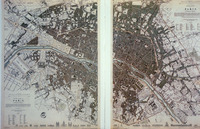
| dc.title | Plan of Western and Eastern Divisions of Paris | en_US |
| dc.type | Image | en_US |
| dc.rights.access | All rights reserved | en_US |
| vra.culturalContext | French | en_US |
| vra.technique | engraving (printing process) | en_US |
| vra.worktype | Engraving (print) | en_US |
| vra.worktype | Plan (map) | en_US |
| dc.contributor.display | draftsman: W. B. Clarke (British, active 1832-1835), engraver: John Shury (British, active 1815-1849) | en_US |


