MIT Libraries logoDome

MIT
View Item 
  • Dome Home
  • Visual Collections
  • Architecture, Urban Planning, and Visual Arts
  • View Item
  • Dome Home
  • Visual Collections
  • Architecture, Urban Planning, and Visual Arts
  • View Item
JavaScript is disabled for your browser. Some features of this site may not work without it.

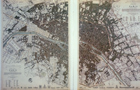
Plan of Western and Eastern Divisions of Paris

Clarke, W. B.; Shury, John
Thumbnail
Download101357_cp.jpg (326.2Kb)
Alternate file
101357_sv.jpg (1.699Mb)
101357_tm.jpg (41.91Kb)
URI
http://hdl.handle.net/1721.3/15655
Description
full view
Type of Work
Engraving (print); Plan (map)
Subject
Cartography, Louis Philippe, King of the French, 1773-1850, Paris (France), Urban planning, Cities and towns, Quarters, Historical geography --Maps, Land use, Urban, City planning
Rights Statement
All rights reserved
Item is Part of
129232
Metadata
Show full item record

Collections
  • Architecture, Urban Planning, and Visual Arts

Browse

All of DomeCommunities & CollectionsBy Issue DateCreatorsTitlesSubjectsThis CollectionBy Issue DateCreatorsTitlesSubjects

My Account

Login
MIT Libraries
PrivacyPermissionsAccessibilityContact us
MIT
Content created by the MIT Libraries, CC BY-NC unless otherwise noted. Notify us about copyright concerns.