| dc.coverage.spatial | Site: Cape Town (South Africa) | en_US |
| dc.coverage.temporal | creation date: settled by slaves, exiles, and traders, 17-18th centuries | en_US |
| dc.creator | Unknown | en_US |
| dc.date | 17-18th centuries | en_US |
| dc.date.accessioned | 2013-01-14T15:20:53Z | |
| dc.date.available | 2013-01-14T15:20:53Z | |
| dc.date.issued | 1600-1799 | en_US |
| dc.identifier | 175113 | en_US |
| dc.identifier.uri | http://hdl.handle.net/1721.3/90865 | |
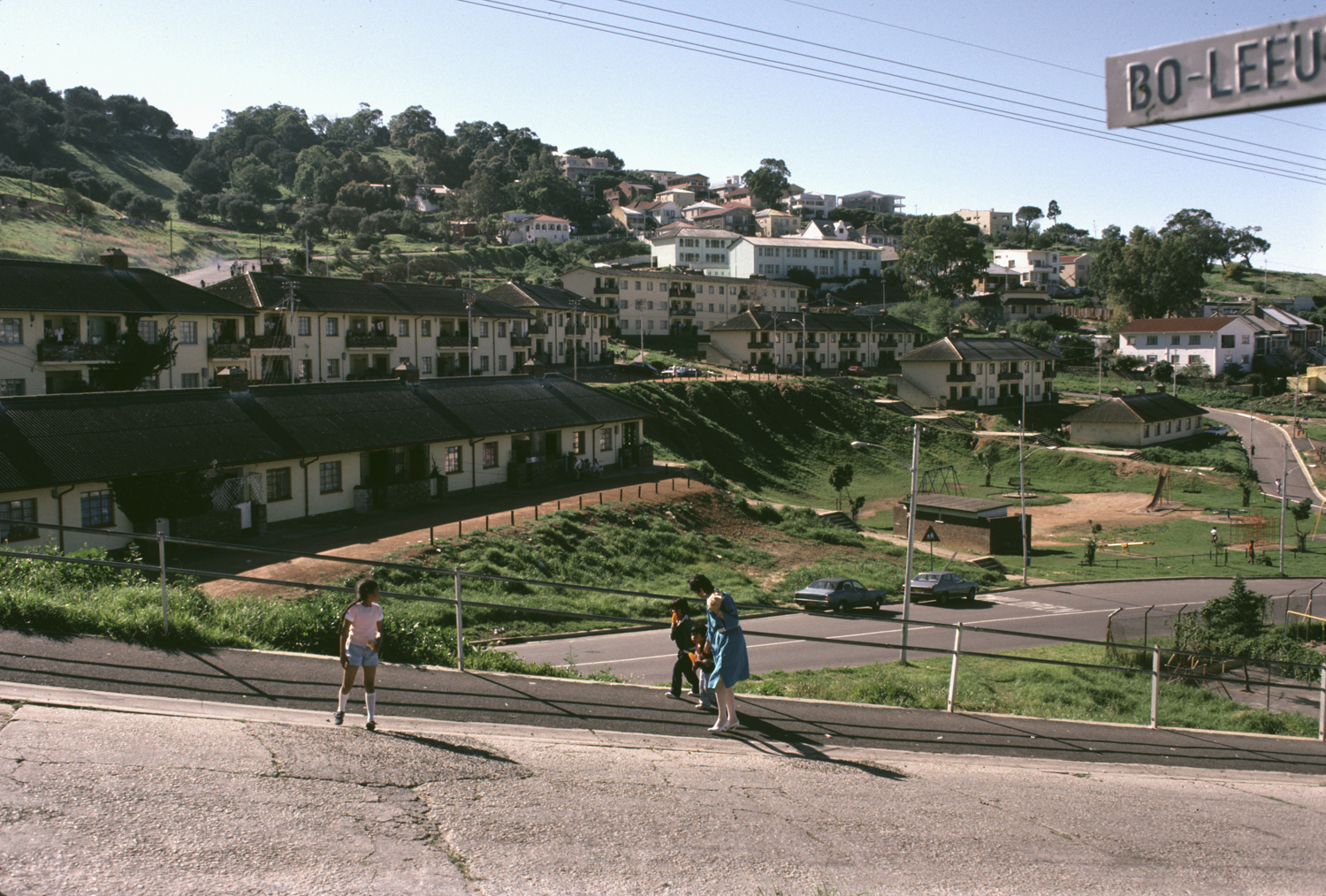
| dc.description | A primarily Muslim area of Cape Town located above the central business district of Cape Town. Known for its cobblestone streets and terraced houses with narrow frontages. Declared a slum in 1934 under the Slums Act and declared a residential area for "Muslim Malays" in 1952 under the Group Areas Act. Part of the Malay Quarter has been declared a National Monument.
Source: Davids, Achmat. The mosques of Bo-Kaap : a social history of Islam at the Cape. South African Institute of Arabic and Islamic Research, 1980. | en_US |
| dc.description | general view, City Council flats seen from Leeuwen Street, 1986 | en_US |
| dc.relation.ispartof | 142919 | en_US |
| dc.rights | (c) 1986 Mohgamat Phaldie Taliep | en_US |
| dc.subject | Neighborhoods | en_US |
| dc.subject | Land use, Urban | en_US |
| dc.subject | Districts | en_US |
| dc.subject | Architecture--South Africa | en_US |
| dc.subject | Bo-Kaap (Cape Town, South Africa) | en_US |
| dc.subject | Apartment houses | en_US |
| dc.subject | Urban renewal | en_US |
| dc.subject | Housing developments | en_US |
| dc.title | Bo-Kaap, Cape Town | en_US |
| dc.title.alternative | Malay Quarter | en_US |
| dc.type | Image | en_US |
| dc.rights.access | All rights reserved | en_US |
| dc.identifier.vendorcode | 11-1 | en_US |
| vra.culturalContext | South African | en_US |
| vra.worktype | Quarter (district) | en_US |
| dc.contributor.display | South African | en_US |