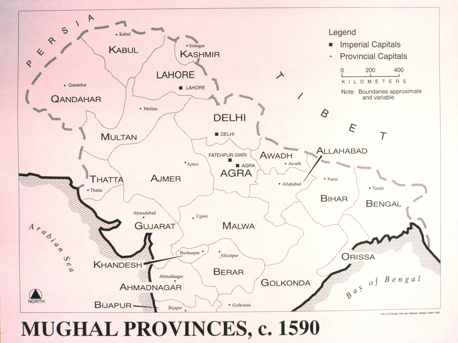
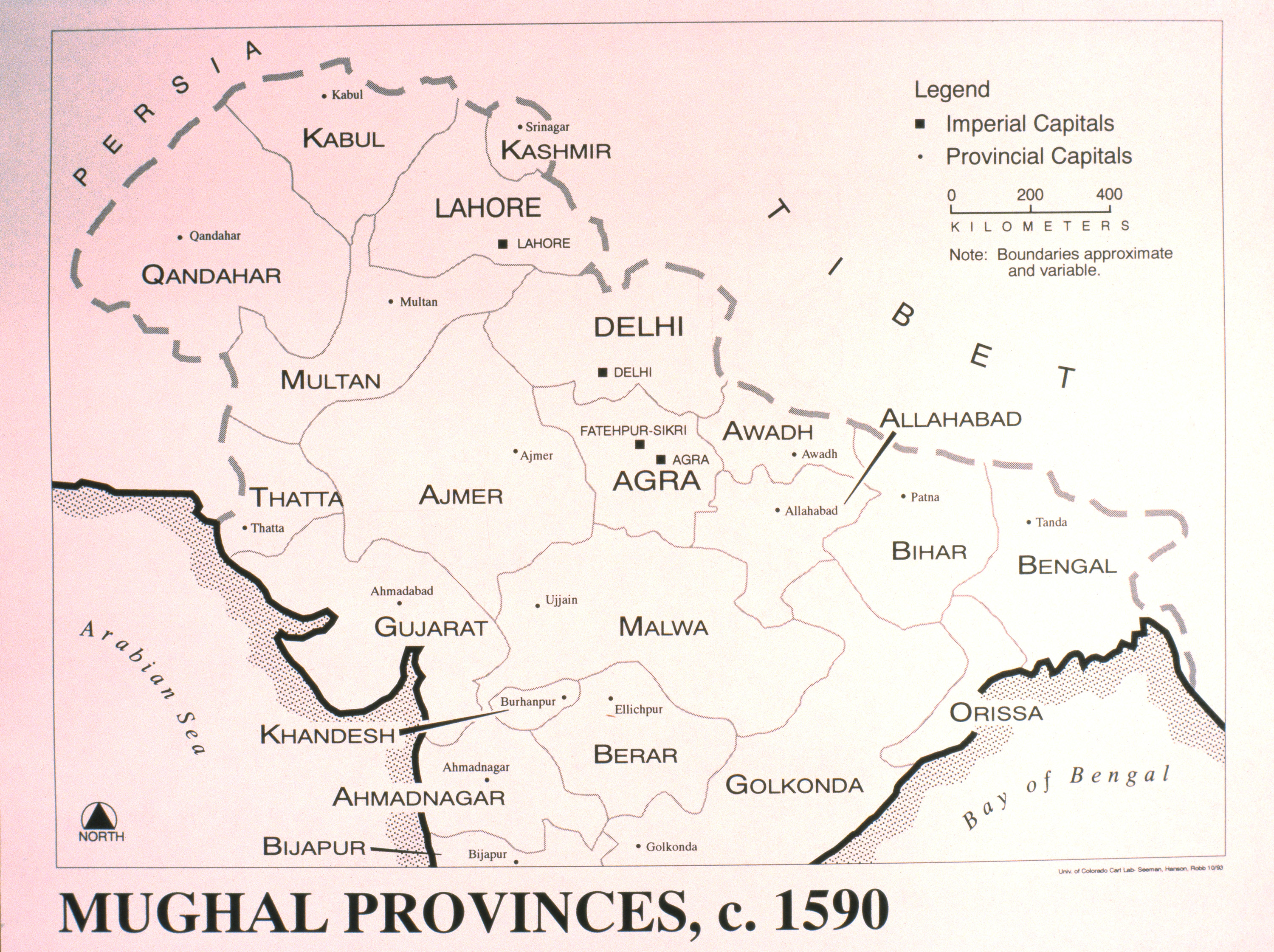
| dc.coverage.temporal | other date: date depicted in map, ca. 1590, creation date: 1993 | en_US |
| dc.creator | University of Colorado, Boulder. Dept. of Geography. Cartography Lab | en_US |
| dc.date.accessioned | 2009-02-06T18:10:51Z | |
| dc.date.available | 2009-02-06T18:10:51Z | |
| dc.identifier | 121754 | en_US |
| dc.identifier.uri | http://hdl.handle.net/1721.3/33548 | en_US |
| dc.description | map | en_US |
| dc.format.medium | paper (fiber product) | en_US |
| dc.format.medium | ink | en_US |
| dc.relation.ispartof | 137221 | en_US |
| dc.rights | (c) James Wescoat | en_US |
| dc.subject | Cartography | en_US |
| dc.subject | Mogul Empire | en_US |
| dc.subject | Historical geography --Maps | en_US |
| dc.subject | India -- Maps | en_US |
| dc.title | Mughal Provinces, c. 1590 | en_US |
| dc.type | Image | en_US |
| dc.rights.access | All rights reserved | en_US |
| vra.culturalContext | Indian (South Asian) | en_US |
| vra.technique | printing | en_US |
| vra.worktype | Map | en_US |
| dc.contributor.display | cartographer: Boulder. Dept. of Geography. Cartography Lab University of Colorado (American, closed ca. 2005) | en_US |