| dc.coverage.temporal | creation date: surveyed, April-June 1898, creation date: Volume I revised, February 1905, creation date: Volume II, May 1905 | en_US |
| dc.creator | Goad, Charles E. | en_US |
| dc.date | April-June 1898 | en_US |
| dc.date.accessioned | 2015-08-31T15:13:27Z | |
| dc.date.available | 2015-08-31T15:13:27Z | |
| dc.date.issued | 1989-1898 | en_US |
| dc.identifier | 258544 | en_US |
| dc.identifier.uri | http://hdl.handle.net/1721.3/174196 | |
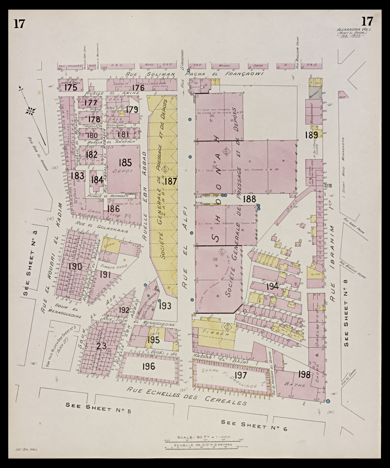
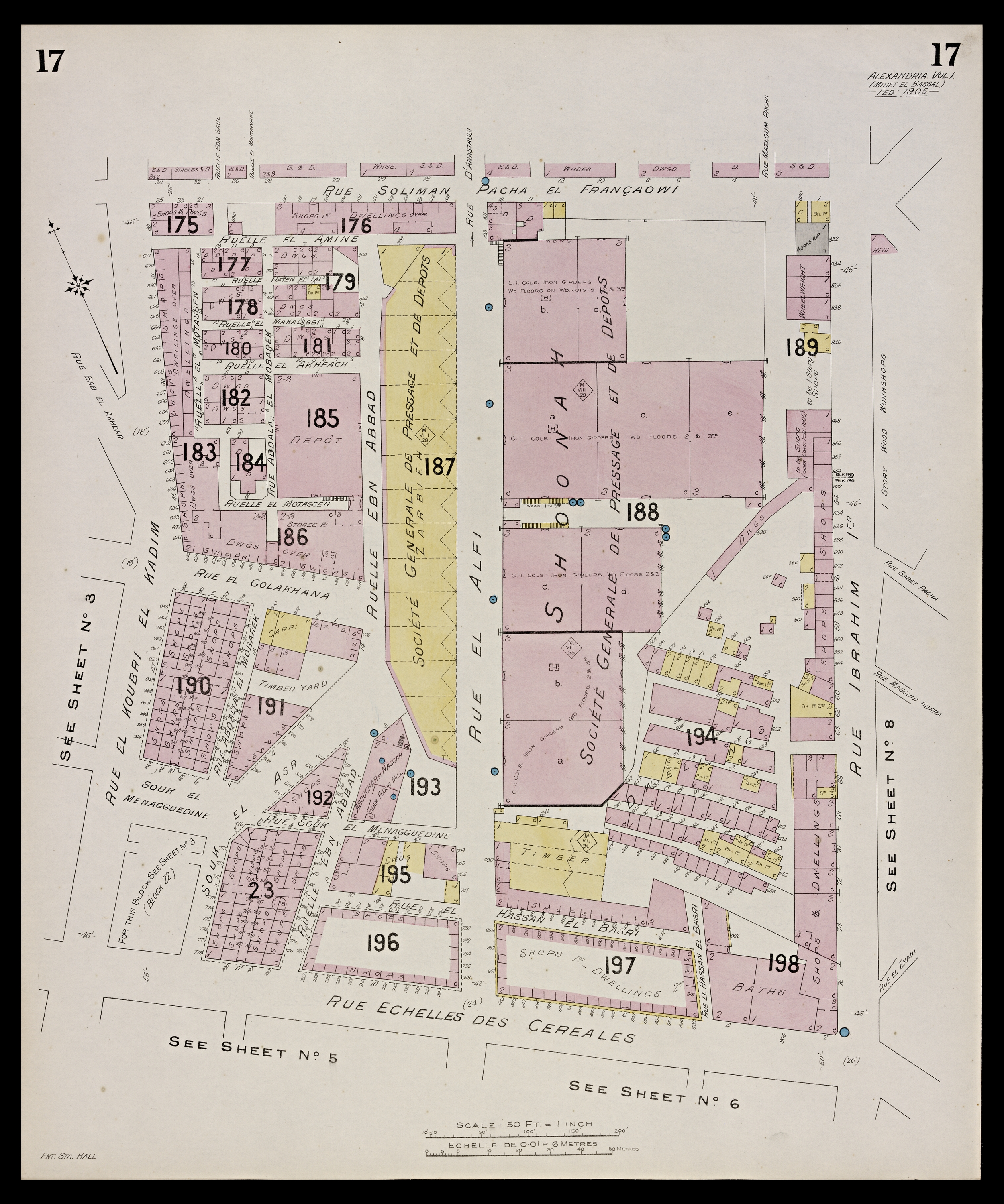
| dc.description | map, Vol. I, Sheet 17 | en_US |
| dc.format.extent | 64 x 53 cm (25.2 x 20.87 inches) | en_US |
| dc.format.medium | paper (fiber product) | en_US |
| dc.relation.ispartof | 144581 | en_US |
| dc.subject | Alexandria (Egypt) | en_US |
| dc.subject | Fire insurance maps | en_US |
| dc.subject | Egypt --Maps | en_US |
| dc.subject | Cities and towns --Egypt | en_US |
| dc.title | Insurance Plan of Alexandria | en_US |
| dc.title.alternative | Insurance Plan of Alexandria, Egypt | en_US |
| dc.type | Image | en_US |
| dc.rights.access | All rights reserved | en_US |
| dc.identifier.vendorcode | Plan-A17.tif | en_US |
| vra.culturalContext | British | en_US |
| vra.culturalContext | Egyptian | en_US |
| vra.technique | printing | en_US |
| vra.technique | cartography | en_US |
| vra.worktype | Map | en_US |
| dc.contributor.display | Civil engineer: Charles E. Goad (British, 1848-1910) | en_US |