| dc.coverage.spatial | Creation: Havana, Ciudad de la Habana, Cuba | en_US |
| dc.coverage.temporal | 1996 (creation) | en_US |
| dc.creator | Gilchrist, Scott | en_US |
| dc.date | 1996 | en_US |
| dc.date.accessioned | 2013-01-11T18:24:49Z | |
| dc.date.available | 2013-01-11T18:24:49Z | |
| dc.date.issued | 1996 | en_US |
| dc.identifier | 182982 | en_US |
| dc.identifier.other | archrefid: 2089 | en_US |
| dc.identifier.uri | http://hdl.handle.net/1721.3/89957 | |
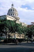
| dc.description | Overall view of El Capitolio (National Capitol Building, 1929), showing dome; La Habana (Havana) was the chief naval station of the Spanish in 16th century (founded 1519); captured by British in 1762, restored in 1763. Site of initial battle of Spanish-American War in 1898; seat of revolutionary government since 1959. Old Havana (Spanish: La Habana Vieja) contains the core of the original city of Havana. The positions of the original Havana city walls are the modern boundaries of Old Havana. Old Havana and its fortifications is a UNESCO World Heritage Site. Source: Thesaurus of Geographic Names (Notes) [website]; http://www.getty.edu/research/conducting_research/vocabularies/tgn/ (accessed 7/15/2010) | en_US |
| dc.format.medium | digital images | en_US |
| dc.rights | © Scott Gilchrist, Archivision, Inc. | en_US |
| dc.subject | cityscape | en_US |
| dc.subject | historical | en_US |
| dc.subject | City planning | en_US |
| dc.subject | Spain--Colonies--America | en_US |
| dc.subject | Twentieth century | en_US |
| dc.title | Old Havana: Topographic Views | en_US |
| dc.type | image | en_US |
| dc.rights.access | Licensed for educational and research use by the MIT community only | en_US |
| dc.identifier.vendorcode | 1B2-CU-OH-F1 | en_US |
| vra.culturalContext | Cuban | en_US |
| vra.technique | photography | en_US |
| vra.worktype | topographical view | en_US |
| vra.worktype | photograph | en_US |
| dc.contributor.display | Scott Gilchrist (Canadian photographer, born 1960) | en_US |


