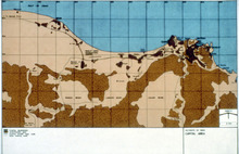
Map of the Sultanate of Oman, Capital Area
| dc.coverage.temporal | creation date: ca. 1980 | en_US |
| dc.creator | Unknown | en_US |
| dc.date | ca. 1980 | en_US |
| dc.date.accessioned | 2011-10-18T15:48:21Z | |
| dc.date.available | 2011-10-18T15:48:21Z | |
| dc.date.issued | 1975-1985 | en_US |
| dc.identifier | 165447 | en_US |
| dc.identifier.uri | http://hdl.handle.net/1721.3/73116 | en_US |
| dc.description | full view | en_US |
| dc.relation.ispartof | 141757 | en_US |
| dc.rights | (c) Llewelyn-Davies Weeks 1984 | en_US |
| dc.subject | Maps | en_US |
| dc.subject | Capital cities | en_US |
| dc.subject | Persian Gulf States | en_US |
| dc.subject | Oman | en_US |
| dc.subject | Muscat (Oman) | en_US |
| dc.title | Map of the Sultanate of Oman, Capital Area | en_US |
| dc.type | Image | en_US |
| dc.rights.access | All rights reserved | en_US |
| vra.culturalContext | Omani | en_US |
| vra.technique | cartography | en_US |
| vra.worktype | Map | en_US |
| dc.contributor.display | Omani | en_US |
Files in this item
This item appears in the following Collection(s)
-
Aga Khan Visual Archive
Images of architecture, urbanism, and the built environment in the Islamic world


