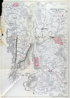
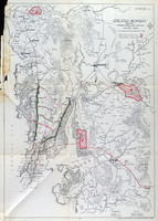
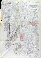
Island of Bombay, Proposed Stages of Development as Part of the Greater Bombay Scheme
| dc.coverage.temporal | creation date: 1948 | en_US |
| dc.creator | Ambdekar, V. N. | en_US |
| dc.creator | Patel, S.D. | en_US |
| dc.date | 1948 | en_US |
| dc.date.accessioned | 2010-09-07T18:14:08Z | |
| dc.date.available | 2010-09-07T18:14:08Z | |
| dc.date.issued | 1948 | en_US |
| dc.identifier | 148694 | en_US |
| dc.identifier.uri | http://hdl.handle.net/1721.3/54742 | en_US |
| dc.description | full view, 1947 | en_US |
| dc.format.medium | paper (fiber product) | en_US |
| dc.format.medium | ink | en_US |
| dc.relation.ispartof | 140243 | en_US |
| dc.subject | Cartography | en_US |
| dc.subject | Urban planning | en_US |
| dc.subject | Historical geography --Maps | en_US |
| dc.subject | Land use, Urban | en_US |
| dc.subject | Bombay (India) | en_US |
| dc.subject | City planning -- India | en_US |
| dc.subject | Mumbai (India) | en_US |
| dc.title | Island of Bombay, Proposed Stages of Development as Part of the Greater Bombay Scheme | en_US |
| dc.type | Image | en_US |
| dc.rights.access | All rights reserved | en_US |
| vra.culturalContext | Indian (South Asian) | en_US |
| vra.technique | cartography | en_US |
| vra.worktype | Map | en_US |
| dc.contributor.display | architect: V. N. Ambdekar (Indian (South Asian), active 20th century), engineer: S.D. Patel (Indian (South Asian), active 20th century) | en_US |


