| dc.coverage.spatial | Site: Las Vegas (Nevada, United States) | en_US |
| dc.creator | American | en_US |
| dc.date | creation date: incorporated as a city, 1940 | en_US |
| dc.date.accessioned | 2010-04-05T15:07:37Z | |
| dc.date.available | 2010-04-05T15:07:37Z | |
| dc.date.issued | 1911 | en_US |
| dc.identifier | 139916 | en_US |
| dc.identifier.other | 139185 | en_US |
| dc.identifier.uri | http://hdl.handle.net/1721.3/50454 | |
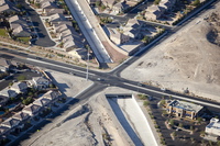
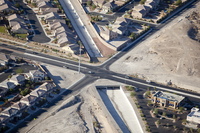
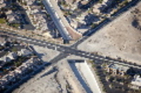
| dc.description | aerial view, drainage canal running through desert housing development and under street intersection, October 25, 2009 | en_US |
| dc.format | construction | en_US |
| dc.subject.lcsh | Southwest (U.S.) | en_US |
| dc.subject.lcsh | Nevada | en_US |
| dc.subject.lcsh | Land use, Urban | en_US |
| dc.subject.lcsh | City planning | en_US |
| dc.subject.lcsh | Aerial views | en_US |
| dc.subject.lcsh | Housing developments | en_US |
| dc.subject.lcsh | Traffic intersections | en_US |
| dc.subject.lcsh | Aerial photography --United States | en_US |
| dc.subject.other | Cities and towns -- United States | en_US |
| dc.subject.other | Drainage | en_US |
| dc.title | City of Las Vegas | en_US |
| dc.title.alternative | City of Las Vegas | en_US |
| dc.type | City | en_US |
| dc.rights.copyright | © Alex S. MacLean / Landslides | en_US |
| dc.rights.access | Licensed for educational and research use by the MIT community only | en_US |
| dc.identifier.vendorcode | 091025-0174 | en_US |


