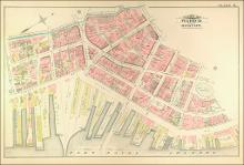
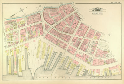
Atlas of the City of Boston, from Actual Surveys and Official Records; City Proper, Volume 1 (1883)
Download139517_cp.jpg (228.4Kb)
Description
page, Plate H: part of ward 12; scale 100 feet per inch; Fort Point Channel, Atlantic Avenue, waterfront
Type of Work
AtlasSubject
Cartography, Urban planning, Boston (Mass.), Atlases, United States -- Maps, Fire insurance maps, Historical geography --Maps, City planning, Wharves, Fort Point Channel Area (Boston, Mass.)
Item is Part of
138996