Atlas of the City of Boston, from Actual Surveys and Official Records; City Proper, Volume 1 (1883)
Download139515_cp.jpg (250.5Kb)
Description
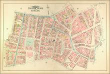
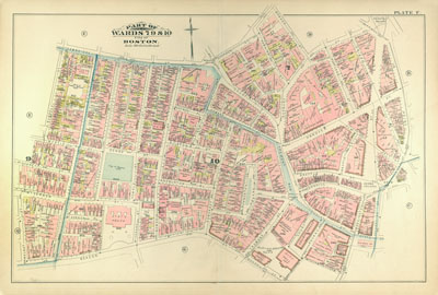
page, Plate F: part of wards 7, 9 & 10; scale 100 feet per inch; Beacon Hill, State House, Pemberton Square, Scollay Square
Type of Work
AtlasSubject
Cartography, Urban planning, Boston (Mass.), Atlases, United States -- Maps, Fire insurance maps, Historical geography --Maps, City planning, Massachusetts State House (Boston, Mass.), Beacon Hill (Boston, Mass.)
Item is Part of
138996