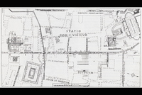
Map of Ancient Rome
Download102180_cp.jpg (280.9Kb)
Date
-753-476Description
map, Campus Martius, showing area along the southern strech of Via Lata (Via Flaminia)
Type of Work
Plan (map)Subject
Urban planning, Historical geography --Maps, Cities and towns --Growth, Land use, Urban, Architecture, Roman, Rome --Antiquities
Rights Statement
All rights reserved
Item is Part of
101772