| dc.contributor.author | American | en_US |
| dc.coverage.spatial | Site: Massachusetts (United States) | en_US |
| dc.coverage.temporal | other date: originally settled, 1630 | |
| dc.creator | American | en_US |
| dc.date | 1630 | en_US |
| dc.date.accessioned | 2010-01-08T21:37:20Z | |
| dc.date.available | 2010-01-08T21:37:20Z | |
| dc.date.issued | 1630 | |
| dc.identifier | 136064 | en_US |
| dc.identifier.other | 138168 | en_US |
| dc.identifier.uri | http://hdl.handle.net/1721.3/46912 | |
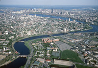
| dc.description | aerial view, Charles River, May 1978 | en_US |
| dc.relation.ispartof | 138168 | en_US |
| dc.subject.lcsh | New England | en_US |
| dc.subject.lcsh | Massachusetts | en_US |
| dc.subject.lcsh | Cityscapes | en_US |
| dc.subject.lcsh | Land use, Urban | en_US |
| dc.subject.lcsh | Cities and towns -- United States | en_US |
| dc.subject.lcsh | Aerial views | en_US |
| dc.subject.lcsh | Harvard University | en_US |
| dc.subject.lcsh | Aerial photography --United States | en_US |
| dc.subject.other | Urban planning | en_US |
| dc.subject.other | Charles River (Mass.) | en_US |
| dc.title | City of Cambridge | en_US |
| dc.title.alternative | City of Cambridge | en_US |
| dc.type | Image | en_US |
| dc.rights.copyright | © Alex S. MacLean / Landslides | en_US |
| dc.rights.access | Licensed for educational and research use by the MIT community only | en_US |
| dc.identifier.vendorcode | LS_0475_33_ | en_US |
| vra.culturalContext | American | en_US |
| vra.worktype | City | en_US |