MIT Libraries logoDome

MIT
View Item 
  • Dome Home
  • Visual Collections
  • Aga Khan Visual Archive
  • View Item
  • Dome Home
  • Visual Collections
  • Aga Khan Visual Archive
  • View Item
JavaScript is disabled for your browser. Some features of this site may not work without it.

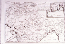
Carte de la Partie Supérieure de l' Inde en deçà du Gange

Bonne, Rigobert
Thumbnail
Download122591_cp.jpg (823.8Kb)
Alternate file
122591_sv.jpg (2.806Mb)
122591_tm.jpg (23.52Kb)
122591.tif (59.81Mb)
Alternative Titles
Map of the Upper Part of India within the Ganges
Carte de la Partie Superieure de l' Inde en deca du Gange
URI
http://hdl.handle.net/1721.3/39068
Date
1765-1775
Description
full view
Type of Work
Map
Subject
Ganges River (India and Bangladesh), Mogul Empire, Historical geography --Maps, India -- Maps
Rights
(c) James Wescoat
Rights Statement
All rights reserved
Item is Part of
137693
Metadata
Show full item record

Collections
  • Aga Khan Visual Archive

Browse

All of DomeCommunities & CollectionsBy Issue DateCreatorsTitlesSubjectsThis CollectionBy Issue DateCreatorsTitlesSubjects

My Account

Login
MIT Libraries
PrivacyPermissionsAccessibilityContact us
MIT
Content created by the MIT Libraries, CC BY-NC unless otherwise noted. Notify us about copyright concerns.