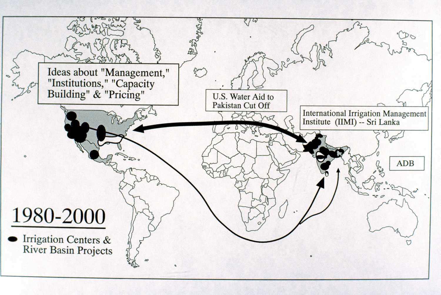
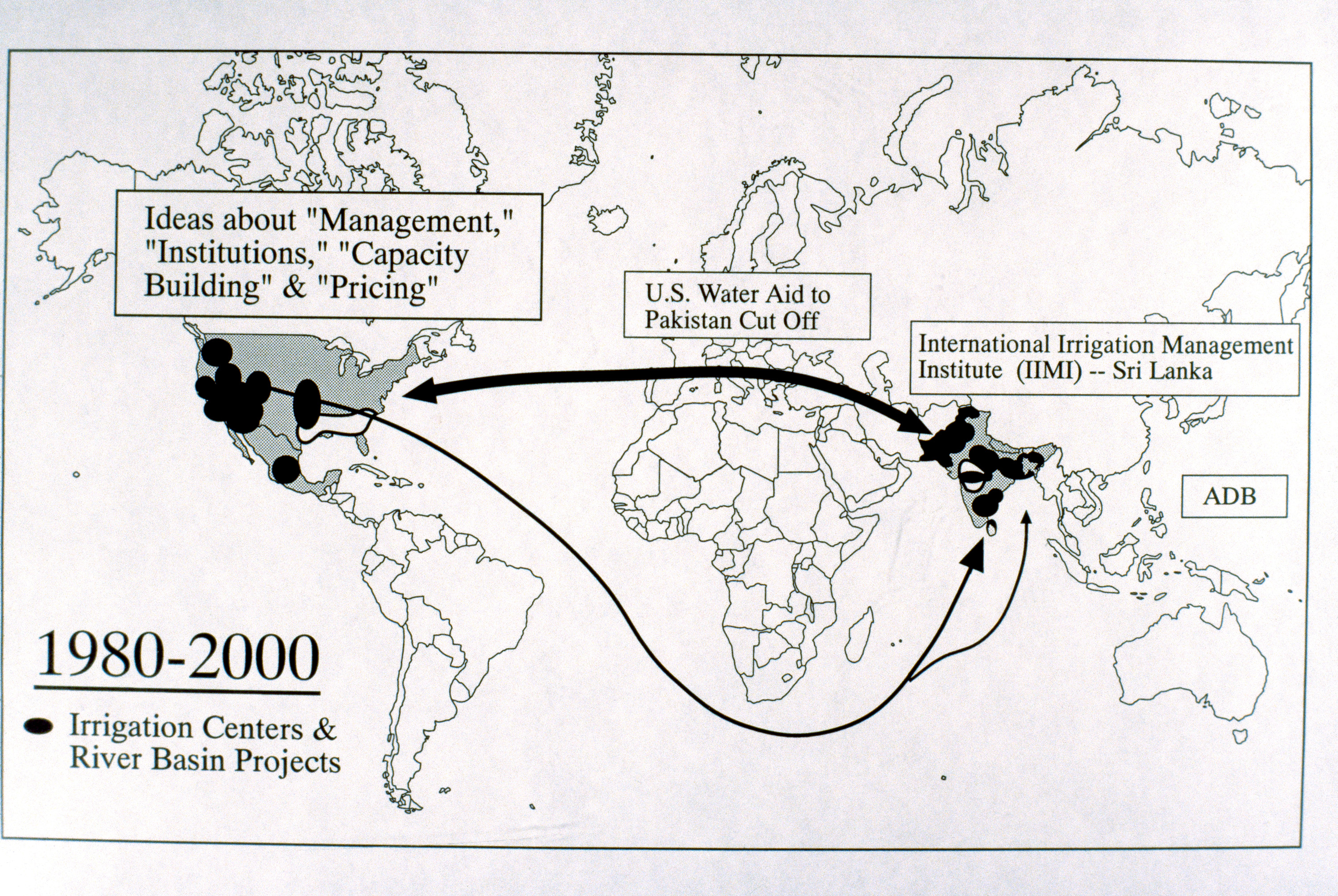
World Map Showing Irrigation Centers
| dc.coverage.temporal | creation date: 20th century | en_US |
| dc.creator | Unknown | en_US |
| dc.date | 20th century | en_US |
| dc.date.accessioned | 2009-03-13T13:46:55Z | |
| dc.date.available | 2009-03-13T13:46:55Z | |
| dc.date.issued | 1900-1999 | en_US |
| dc.identifier | 122115 | en_US |
| dc.identifier.uri | http://hdl.handle.net/1721.3/36746 | en_US |
| dc.description | full view, 1980-2000, irrigation centers and river basin projects | en_US |
| dc.format.medium | paper (fiber product) | en_US |
| dc.format.medium | ink | en_US |
| dc.relation.ispartof | 137346 | en_US |
| dc.rights | (c) James Wescoat | en_US |
| dc.subject | United States -- Maps | en_US |
| dc.subject | World maps | en_US |
| dc.subject | Irrigation systems | en_US |
| dc.subject | Trade routes | en_US |
| dc.subject | Water-supply | en_US |
| dc.subject | International trade | en_US |
| dc.subject | India -- Maps | en_US |
| dc.title | World Map Showing Irrigation Centers | en_US |
| dc.type | Image | en_US |
| dc.rights.access | All rights reserved | en_US |
| vra.technique | cartography | en_US |
| vra.worktype | Map | en_US |
Files in this item


This item appears in the following Collection(s)
-
Aga Khan Visual Archive
Images of architecture, urbanism, and the built environment in the Islamic world