| dc.creator | unknown (Italian) | en_US |
| dc.date.accessioned | 2008-09-03T13:19:52Z | |
| dc.date.available | 2008-09-03T13:19:52Z | |
| dc.identifier | 123801 | en_US |
| dc.identifier.uri | http://hdl.handle.net/1721.3/29346 | en_US |
| dc.description | map | en_US |
| dc.format.medium | paper (fiber product) | en_US |
| dc.format.medium | ink | en_US |
| dc.relation.ispartof | 134358 | en_US |
| dc.subject | Cartography | en_US |
| dc.subject | Walls | en_US |
| dc.subject | Architecture, Renaissance | en_US |
| dc.subject | Historical geography --Maps | en_US |
| dc.subject | City planning | en_US |
| dc.subject | Plans (maps) | en_US |
| dc.subject | Perugia (Italy) | en_US |
| dc.subject | Sangallo, Antonio da, 1484-1546 | en_US |
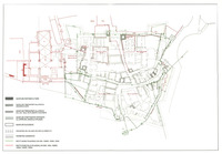
| dc.title | Map of Perugia showing walls, perimeters of structures, and polygons from plans by Antonio da Sangallo the younger | en_US |
| dc.type | Image | en_US |
| dc.rights.access | All rights reserved | en_US |
| vra.culturalContext | Italian | en_US |
| vra.technique | cartography | en_US |
| vra.worktype | Map | en_US |
| dc.contributor.display | unknown (Italian) | en_US |


