| dc.coverage.temporal | publication date: 1966 | en_US |
| dc.creator | Wallace, McHarg, Roberts, and Todd | en_US |
| dc.creator | Whittlesey, Conklin and Rossant | en_US |
| dc.creator | Alan M. Voorhees & Associates, Inc. | en_US |
| dc.date | 1966 | en_US |
| dc.date.accessioned | 2017-05-31T19:47:08Z | |
| dc.date.available | 2017-05-31T19:47:08Z | |
| dc.date.issued | 1966 | en_US |
| dc.identifier | 277349 | en_US |
| dc.identifier.uri | http://hdl.handle.net/1721.3/185436 | |
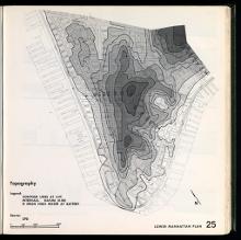
| dc.description | map, Topography | en_US |
| dc.format.medium | paper (fiber product) | en_US |
| dc.format.medium | ink | en_US |
| dc.relation.ispartof | 144947 | en_US |
| dc.subject | Urban planning | en_US |
| dc.subject | New York (N.Y.) | en_US |
| dc.subject | City planning -- New York | en_US |
| dc.subject | Topographic maps | en_US |
| dc.title | Lower Manhattan Plan: Capital Project ES-1 | en_US |
| dc.title.alternative | The Lower Manhattan Plan: Capital Project ES-1 | en_US |
| dc.type | Image | en_US |
| vra.culturalContext | American | en_US |
| vra.technique | printing | en_US |
| vra.worktype | Municipal plan | en_US |
| dc.contributor.display | City planner: Wallace, McHarg, Roberts, and Todd (American, 1963-1979), City planner: Whittlesey, Conklin and Rossant (American, active late 20th century), Consultant: Alan M. Voorhees & Associates, Inc. (American, active late 20th century) | en_US |

