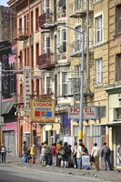
San Francisco: Topographic Street Views
Gilchrist, Scott

Download1A2-US-SF-SS-B47_cp.jpg (629.9Kb)
Alternate file
Date
2014Description
People waiting in line for a soup kitchen in skid row, South of Market Area (SoMa); The only consolidated city-county in California. San Francisco encompasses a land area of about 46.9 square miles (121 km2) on the northern end of the San Francisco Peninsula, which makes it the smallest county in the state. It has a density of about 18,187 people per square mile (7,022 people per km2), making it the most densely settled large city (population greater than 200,000) in the state of California and the second-most densely populated major city in the United States after New York City. Source: Wikipedia; http://en.wikipedia.org/wiki/Main_Page (accessed 9/2/2015)
Type of Work
topographical view; photographSubject
architecture, business, commerce and trade, cityscape, contemporary (1960 to present), City planning, Twenty-first century
Rights
Rights Statement
Licensed for educational and research use by the MIT community only