| dc.coverage.spatial | Creation Site: Seoul, Seoul (special city), South Korea, Asia, | en_US |
| dc.coverage.temporal | photographed 2014 (creation) | en_US |
| dc.creator | Gilchrist, Scott | en_US |
| dc.date | 2014 | en_US |
| dc.date.accessioned | 2016-07-01T18:41:08Z | |
| dc.date.available | 2016-07-01T18:41:08Z | |
| dc.date.issued | 2014 | en_US |
| dc.identifier | 265708 | en_US |
| dc.identifier.other | archrefid: 3440 | en_US |
| dc.identifier.uri | http://hdl.handle.net/1721.3/181766 | |
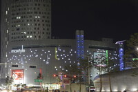
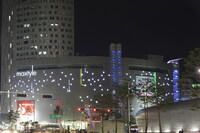
| dc.description | Dongdaemun Market area (Jogno-gu, central Seoul) at night; Officially the Seoul Special City, it is the capital and largest metropolis of South Korea, forming the heart of the Seoul Capital Area, which includes the surrounding Incheon metropolis and Gyeonggi province, the world's second largest metropolitan area with over 25.6 million people. Emporis ranked Seoul's skyline having the world's fourth highest visual impact among major cities. The city is divided by the Han River and the newest development is in the Gangnam district, which literally means "south of the river". Source: Wikipedia; http://en.wikipedia.org/wiki/Main_Page (accessed 8/30/2015) | en_US |
| dc.format.medium | digital images | en_US |
| dc.rights | © Scott Gilchrist, Archivision, Inc. | en_US |
| dc.subject | architecture | en_US |
| dc.subject | business, commerce and trade | en_US |
| dc.subject | cityscape | en_US |
| dc.subject | contemporary (1960 to present) | en_US |
| dc.subject | Twenty-first century | en_US |
| dc.title | Seoul: Topographic Views | en_US |
| dc.type | image | en_US |
| dc.rights.access | Licensed for educational and research use by the MIT community only | en_US |
| dc.identifier.vendorcode | 1A2-SK-S-TV-A09 | en_US |
| vra.culturalContext | South Korean | en_US |
| vra.technique | photography | en_US |
| vra.worktype | topographical view | en_US |
| vra.worktype | photograph | en_US |
| dc.contributor.display | Scott Gilchrist (Canadian distributor, born 1960) | en_US |

