| dc.coverage.spatial | Site: Korea | en_US |
| dc.coverage.temporal | created 1953 (creation) | en_US |
| dc.creator | United Nations | en_US |
| dc.date | 1953 | en_US |
| dc.date.accessioned | 2016-07-01T18:40:27Z | |
| dc.date.available | 2016-07-01T18:40:27Z | |
| dc.date.issued | 1953 | en_US |
| dc.identifier | 265568 | en_US |
| dc.identifier.other | archrefid: 3447 | en_US |
| dc.identifier.uri | http://hdl.handle.net/1721.3/181626 | |
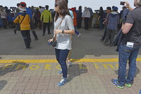
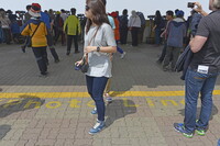
| dc.description | Tourists on DMZ tour at Dora Observatory with lines permitting photography marked; The Korean DMZ is a strip of land running across the Korean Peninsula; it was established at the end of the Korean War to serve as a buffer zone between North and South Korea. The DMZ is a de facto border barrier, which runs in the vicinity of the 38th parallel north (the division between North and South Korean created at the end of WWII and formalized in 1948). Despite its name, it is the most heavily militarized border in the world. It was created as part of the Korean Armistice Agreement between North Korea, the People's Republic of China, and the United Nations Command forces in 1953. There are two small villages which were allowed to stay within the DMZ boundaries; they are governed and protected by the United Nations. Source: Wikipedia; http://en.wikipedia.org/wiki/Main_Page (accessed 8/18/2015) | en_US |
| dc.rights | © Scott Gilchrist, Archivision, Inc. | en_US |
| dc.subject | military or war | en_US |
| dc.subject | Korean War, 1950-1953 | en_US |
| dc.subject | World War, 1939-1945 | en_US |
| dc.subject | Twentieth century | en_US |
| dc.title | Korean Demilitarized Zone (DMZ) | en_US |
| dc.title.alternative | 한반도 비무장지대 | en_US |
| dc.type | image | en_US |
| dc.rights.access | Licensed for educational and research use by the MIT community only | en_US |
| dc.identifier.vendorcode | 1A2-SK-DMZ-A28 | en_US |
| vra.culturalContext | Korean | en_US |
| vra.technique | construction (assembling) | en_US |
| vra.worktype | border (boundary) | en_US |
| dc.contributor.display | United Nations (international organization, established 1945) | en_US |

