| dc.coverage.spatial | Creation Site: Niagara Falls (waterfall), North and Central America, | en_US |
| dc.coverage.temporal | photographed 2001 (creation) | en_US |
| dc.creator | Gilchrist, Scott | en_US |
| dc.date | 2001 | en_US |
| dc.date.accessioned | 2016-07-01T18:40:04Z | |
| dc.date.available | 2016-07-01T18:40:04Z | |
| dc.date.issued | 2001 | en_US |
| dc.identifier | 265489 | en_US |
| dc.identifier.other | archrefid: 3282 | en_US |
| dc.identifier.uri | http://hdl.handle.net/1721.3/181550 | |
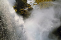
| dc.description | Horseshoe Falls on the Canadian side, close up of moving water; Niagara Falls is the collective name for three waterfalls that straddle the international border between Canada and the United States; more specifically, between the province of Ontario and the state of New York. They form the southern end of the Niagara Gorge. From largest to smallest, the three waterfalls are the Horseshoe Falls, the American Falls and the Bridal Veil Falls. The Horseshoe Falls lie mostly on the Canadian side and the American Falls entirely on the American side, separated by Goat Island. Source: Wikipedia; http://en.wikipedia.org/wiki/Main_Page (accessed 9/6/2015) | en_US |
| dc.format.medium | digital images | en_US |
| dc.rights | © Scott Gilchrist, Archivision, Inc. | en_US |
| dc.subject | landscape | en_US |
| dc.subject | Rainbows | en_US |
| dc.subject | Rivers | en_US |
| dc.subject | Waterfalls | en_US |
| dc.subject | Twenty-first century | en_US |
| dc.title | Niagara Falls: Topographic Views | en_US |
| dc.type | image | en_US |
| dc.rights.access | Licensed for educational and research use by the MIT community only | en_US |
| dc.identifier.vendorcode | 1A2-NA-NF-E06 | en_US |
| vra.culturalContext | North American | en_US |
| vra.technique | photography | en_US |
| vra.worktype | topographical view | en_US |
| vra.worktype | photograph | en_US |
| dc.contributor.display | Scott Gilchrist (Canadian photographer, born 1960) | en_US |

