| dc.coverage.spatial | Creation Site: Ahmadābād, Gujarāt, India, Asia, | en_US |
| dc.coverage.temporal | photographed 2014 (creation) | en_US |
| dc.creator | Gilchrist, Scott | en_US |
| dc.date | 2014 | en_US |
| dc.date.accessioned | 2016-07-01T18:03:42Z | |
| dc.date.available | 2016-07-01T18:03:42Z | |
| dc.date.issued | 2014 | en_US |
| dc.identifier | 265032 | en_US |
| dc.identifier.other | archrefid: 3476 | en_US |
| dc.identifier.uri | http://hdl.handle.net/1721.3/181159 | |
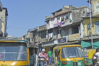
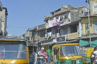
| dc.description | Crowded area with auto rickshaws and apartment buildings; Also known as Ahmadābād, located on Sābarmati river, north of Bombay (Mumbai); founded by Muslim Sultan Aḥmad Shāh, ruler of Gujarat; seized by Mughal emperor Akbar in 1572. Half of the population is employed in cotton industry; first cotton mills opened 1859-1861; has light manufacturing. With a population of more than 5.5 million and an extended population of 6.3 million, it is the sixth largest city and seventh largest metropolitan area of India. Source: Wikipedia; http://en.wikipedia.org/wiki/Main_Page (accessed 8/28/2015) | en_US |
| dc.format.medium | digital images | en_US |
| dc.rights | © Scott Gilchrist, Archivision, Inc. | en_US |
| dc.subject | architecture | en_US |
| dc.subject | cityscape | en_US |
| dc.subject | contemporary (1960 to present) | en_US |
| dc.subject | genre | en_US |
| dc.subject | Twenty-first century | en_US |
| dc.title | Ahmedabad: Topographic Views | en_US |
| dc.type | image | en_US |
| dc.rights.access | Licensed for educational and research use by the MIT community only | en_US |
| dc.identifier.vendorcode | 1A2-IN-STV-D83 | en_US |
| vra.culturalContext | Indian (South Asian) | en_US |
| vra.technique | photography | en_US |
| vra.worktype | topographical view | en_US |
| vra.worktype | photograph | en_US |
| dc.contributor.display | Scott Gilchrist (Canadian distributor, born 1960) | en_US |


