MIT Libraries logoDome

MIT
View Item 
  • Dome Home
  • Visual Collections
  • Selected City Plans
  • View Item
  • Dome Home
  • Visual Collections
  • Selected City Plans
  • View Item
JavaScript is disabled for your browser. Some features of this site may not work without it.

A Comprehensive City Plan for Wichita, Kansas

Bartholomew, Harland; City Planning Commission of Wichita
Thumbnail
Download260515_cp.jpg (168.5Kb)
Alternate file
260515_sv.jpg (769.3Kb)
URI
http://hdl.handle.net/1721.3/176296
Date
1923
Description
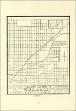
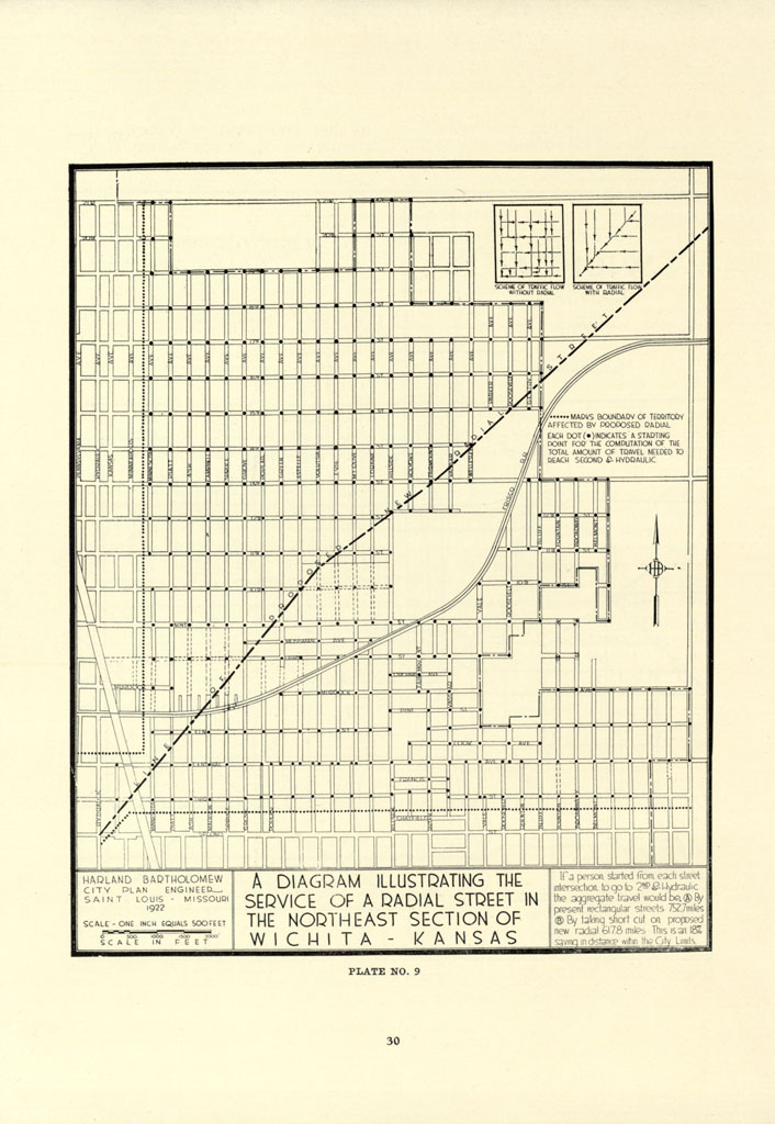
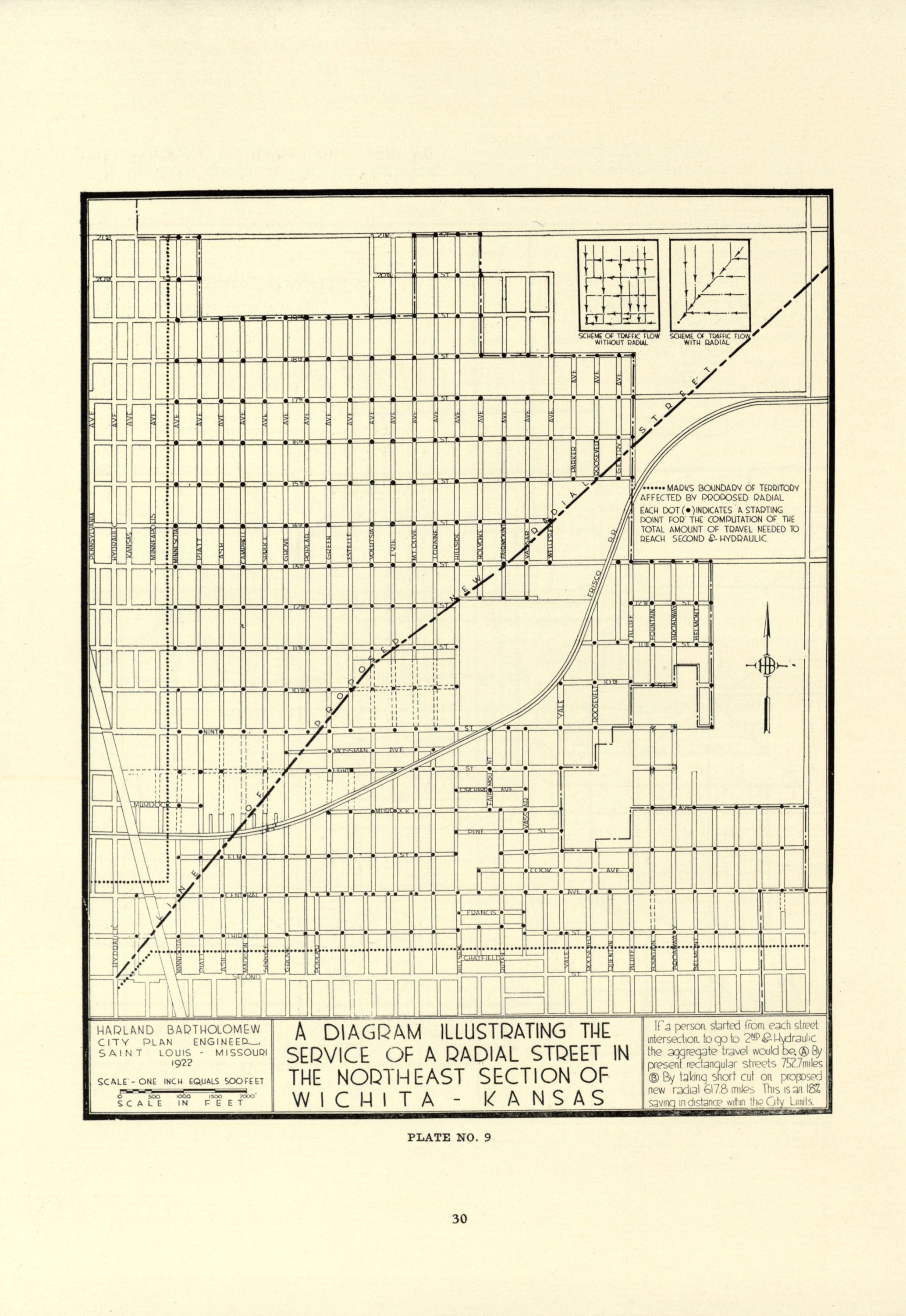
map, A Diagram Illustrating the Service of a Radial Street in the Northeast Section of Wichita, Kansas
Type of Work
Municipal plan
Subject
Kansas, Urban planning, Wichita (Kans.), City planning -- Kansas, Streets
Item is Part of
144732
Metadata
Show full item record

Collections
  • Selected City Plans

Browse

All of DomeCommunities & CollectionsBy Issue DateCreatorsTitlesSubjectsThis CollectionBy Issue DateCreatorsTitlesSubjects

My Account

Login
MIT Libraries
PrivacyPermissionsAccessibilityContact us
MIT
Content created by the MIT Libraries, CC BY-NC unless otherwise noted. Notify us about copyright concerns.