Plan Piloto de la Habana
| dc.coverage.temporal | publication date: 1959 | en_US |
| dc.creator | Town Planning Associates | en_US |
| dc.date | 1959 | en_US |
| dc.date.accessioned | 2015-11-04T18:35:40Z | |
| dc.date.available | 2015-11-04T18:35:40Z | |
| dc.date.issued | 1959 | en_US |
| dc.identifier | 260234 | en_US |
| dc.identifier.uri | http://hdl.handle.net/1721.3/175750 | |
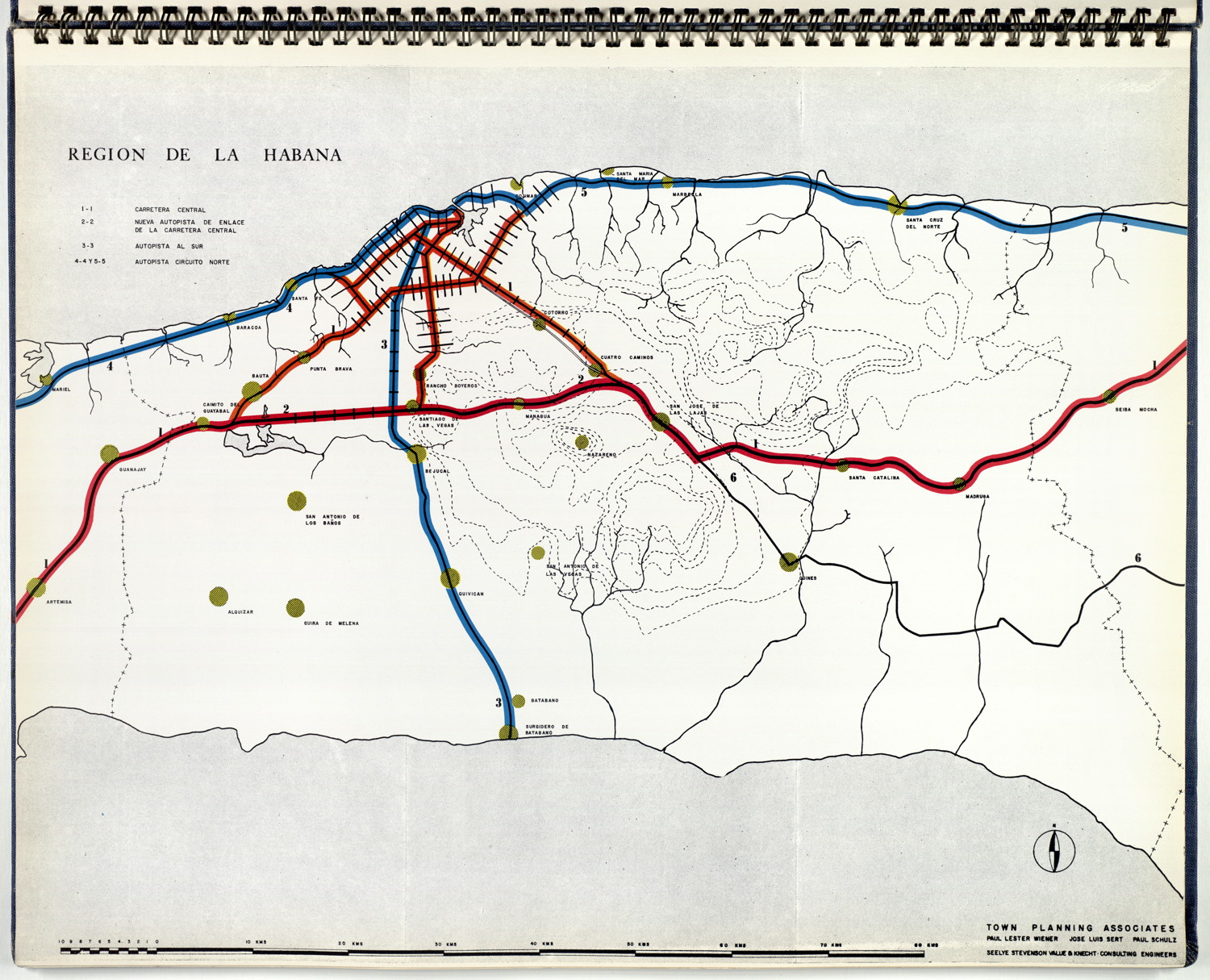
| dc.description | map, highways and roads in the Havana region | en_US |
| dc.relation.ispartof | 144710 | en_US |
| dc.subject | Urban planning | en_US |
| dc.subject | Havana (Cuba) | en_US |
| dc.subject | City planning -- Cuba | en_US |
| dc.subject | Highways | en_US |
| dc.subject | Roads | en_US |
| dc.subject | Thematic maps | en_US |
| dc.title | Plan Piloto de la Habana | en_US |
| dc.type | Image | en_US |
| dc.identifier.vendorcode | Plan_Habana_13 | en_US |
| vra.culturalContext | American | en_US |
| vra.worktype | Municipal plan | en_US |
| dc.contributor.display | Architectural firm: Town Planning Associates (American, 1939-1957) | en_US |
Files in this item

This item appears in the following Collection(s)
-
Selected City Plans
Selected City Plans