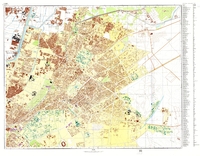
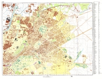
Cairo (H-36-63, 75)
| dc.coverage.temporal | publication date: 1972 | en_US |
| dc.creator | Soviet Union. Sovetskai︠a︡ Armii︠a︡. Generalʹnyĭ shtab | en_US |
| dc.date | 1972 | en_US |
| dc.date.accessioned | 2015-01-22T17:33:01Z | |
| dc.date.available | 2015-01-22T17:33:01Z | |
| dc.date.issued | 1972 | en_US |
| dc.identifier | 256505 | en_US |
| dc.identifier.uri | http://hdl.handle.net/1721.3/172440 | |
| dc.description | map, Part 2 of 4. See image 256507 for the key, or image 256508 for a mosaic map of all 4 parts. | en_US |
| dc.format.extent | scale: 1:10,000 | en_US |
| dc.format.medium | paper (fiber product) | en_US |
| dc.format.medium | ink | en_US |
| dc.relation.ispartof | 144415 | en_US |
| dc.subject | Maps | en_US |
| dc.subject | Cairo (Egypt) | en_US |
| dc.subject | Land use, Urban | en_US |
| dc.subject | Egypt --Maps | en_US |
| dc.title | Cairo (H-36-63, 75) | en_US |
| dc.title.alternative | Каир (H-36-63, 75) | en_US |
| dc.title.alternative | Kair (H-36-63, 75) | en_US |
| dc.title.alternative | Map of Cairo | en_US |
| dc.type | Image | en_US |
| dc.rights.access | Licensed for educational and research use by the MIT community only | en_US |
| dc.identifier.vendorcode | Cairo2 | en_US |
| vra.technique | cartography | en_US |
| vra.worktype | Map | en_US |
| dc.contributor.display | Publisher: Soviet Union. Sovetskai︠a︡ Armii︠a︡. Generalʹnyĭ shtab (Soviet) | en_US |
Files in this item
This item appears in the following Collection(s)
-
Architecture, Urban Planning, and Visual Arts
Online Image Collection


