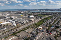
East Boston
Download247205_cp.jpg (653.3Kb)
Date
1836Description
aerial view, highway next to Logan Airport, 6/28/2012
Type of Work
NeighborhoodSubject
Urban planning, Boston (Mass.), Neighborhoods, Urban areas, Land use, Urban, City planning, Highways, Aerial views, Logan Airport (Boston, MA), Aerial photography --United States
Rights
Rights Statement
Licensed for educational and research use by the MIT community only
Item is Part of
143866