

Fisher Hill
Download160393_cp.jpg (835.0Kb)


Alternative Title
Brookline Hill
Date
1884Description
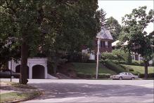
Estate subdivision of 165 acres laid out to accommodate topography and discourage through traffic. general view, house with two-car detached garage at the intersection of Fisher Avenue and Clinton Road, 1987
Type of Work
Housing development, NeighborhoodSubject
Suburbs, Neighborhoods, Architecture, Modern --19th century, Housing developments, Architecture, Domestic --United States, National Register of Historic Places, Brookline (Mass.), Residential districts, Subdivisions, Streets, Garages, Traffic intersections, Boston Suburbs - Chapter 2 - 1865-1910
Rights
Rights Statement
Creative Commons Attribution-NonCommercial 3.0 http://creativecommons.org/licenses/by-nc/3.0/
Item is Part of
141092