MIT Libraries homeMIT Libraries logoDome

MIT
View Item 
  • Dome Home
  • Visual Collections
  • Aga Khan Visual Archive
  • View Item
  • Dome Home
  • Visual Collections
  • Aga Khan Visual Archive
  • View Item
JavaScript is disabled for your browser. Some features of this site may not work without it.

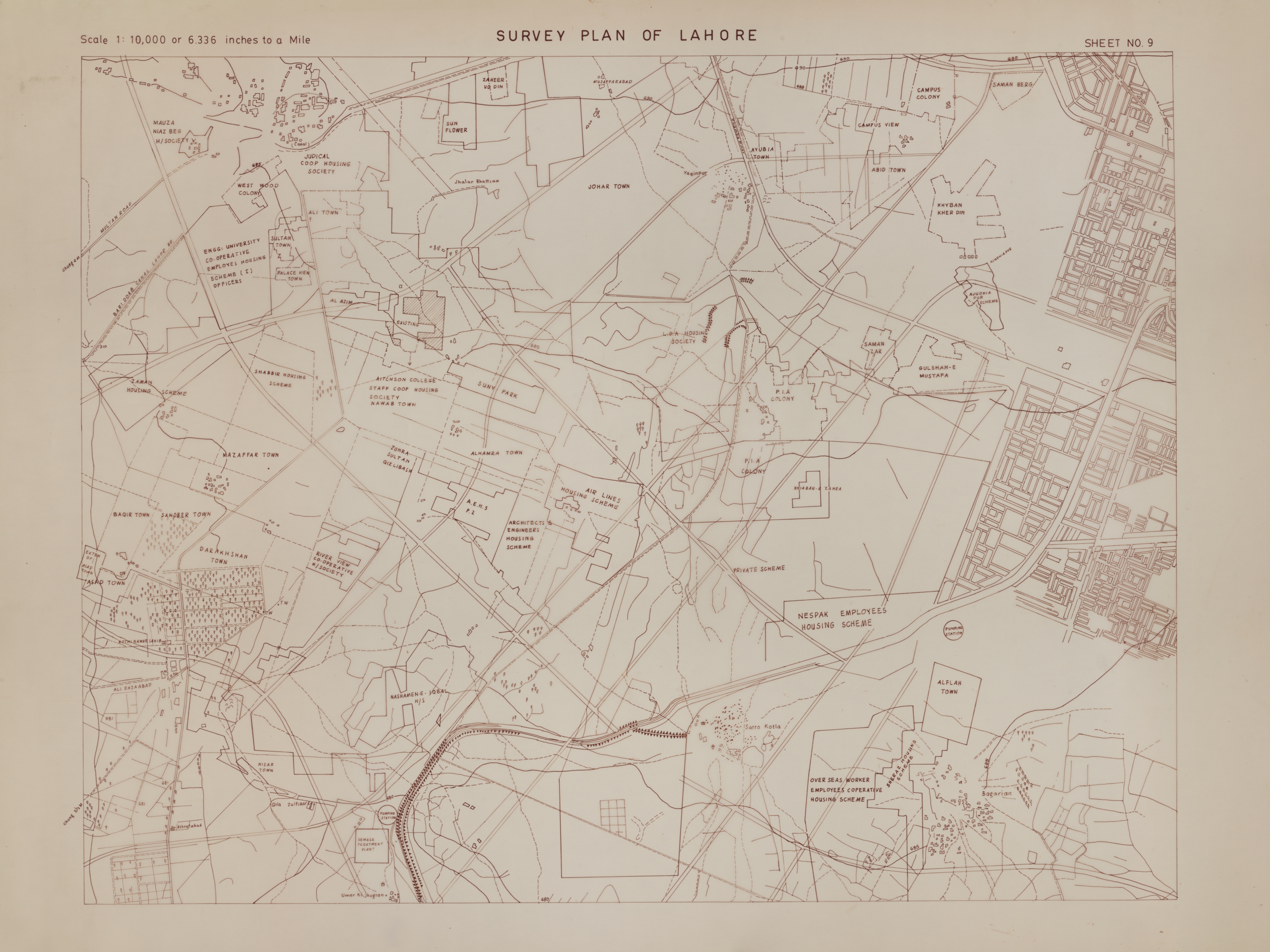
Survey Plan of Lahore

Pakistani
Thumbnail
Download246600_cp.jpg (1.049Mb)
Alternate file
246600_sv.jpg (3.787Mb)
246600_tm.jpg (7.698Kb)
URI
http://hdl.handle.net/1721.3/154984
Date
1920-1929
Description
map, Sheet No. 9
Type of Work
Plan (map)
Subject
Maps, Urban planning, Lahore (Pakistan), Historical geography --Maps, Land use, Urban, City planning, Plans (maps)
Rights
Courtesy of James Wescoat
Rights Statement
All rights reserved
Item is Part of
143781
Metadata
Show full item record

Collections
  • Aga Khan Visual Archive

Browse

All of DomeCommunities & CollectionsBy Issue DateCreatorsTitlesSubjectsThis CollectionBy Issue DateCreatorsTitlesSubjects

My Account

LoginRegister
MIT Libraries homeMIT Libraries logo

Find us on

Twitter Facebook Instagram YouTube RSS

MIT Libraries navigation

SearchHours & locationsBorrow & requestResearch supportAbout us
PrivacyPermissionsAccessibility
MIT
Massachusetts Institute of Technology
Content created by the MIT Libraries, CC BY-NC unless otherwise noted. Notify us about copyright concerns.