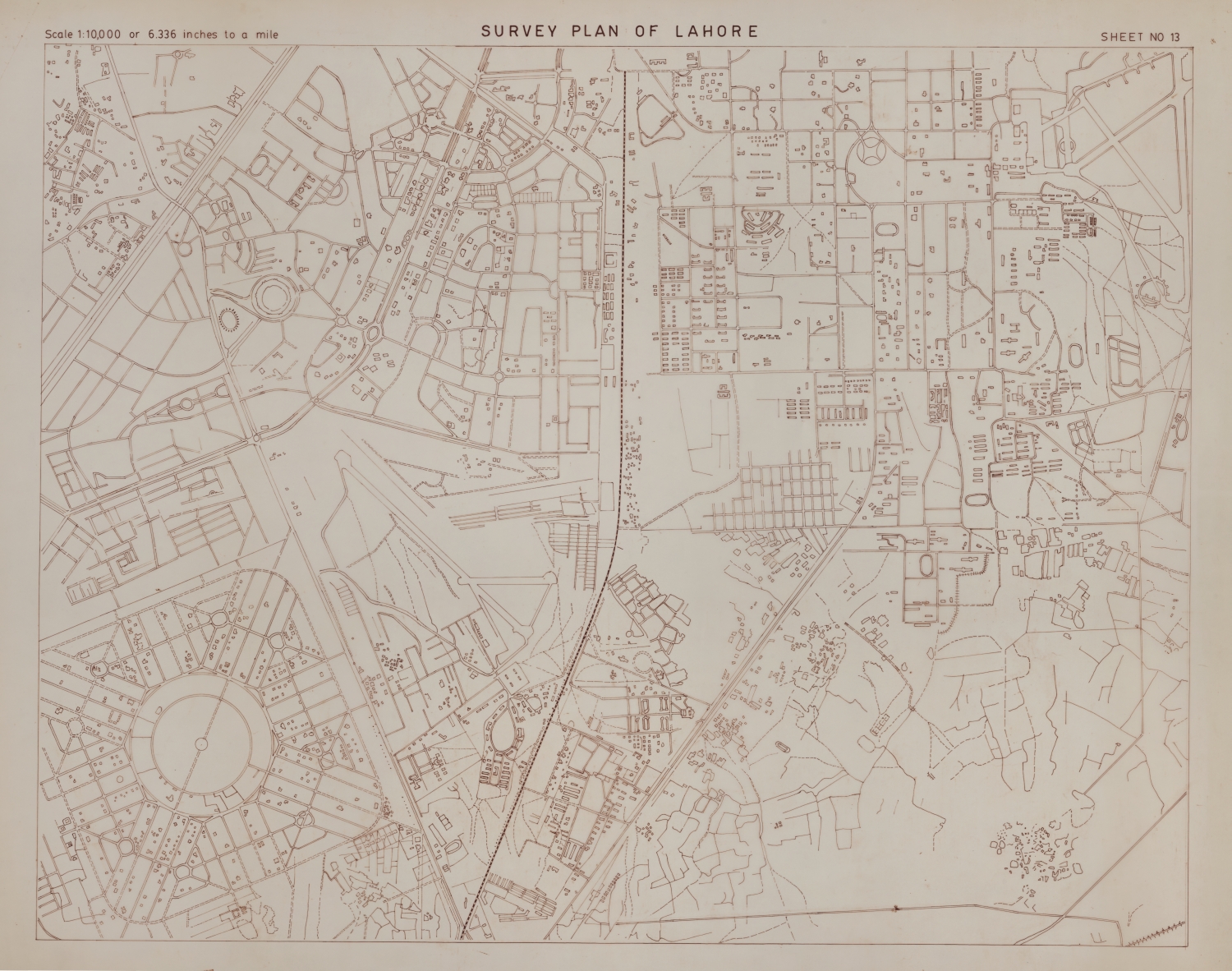
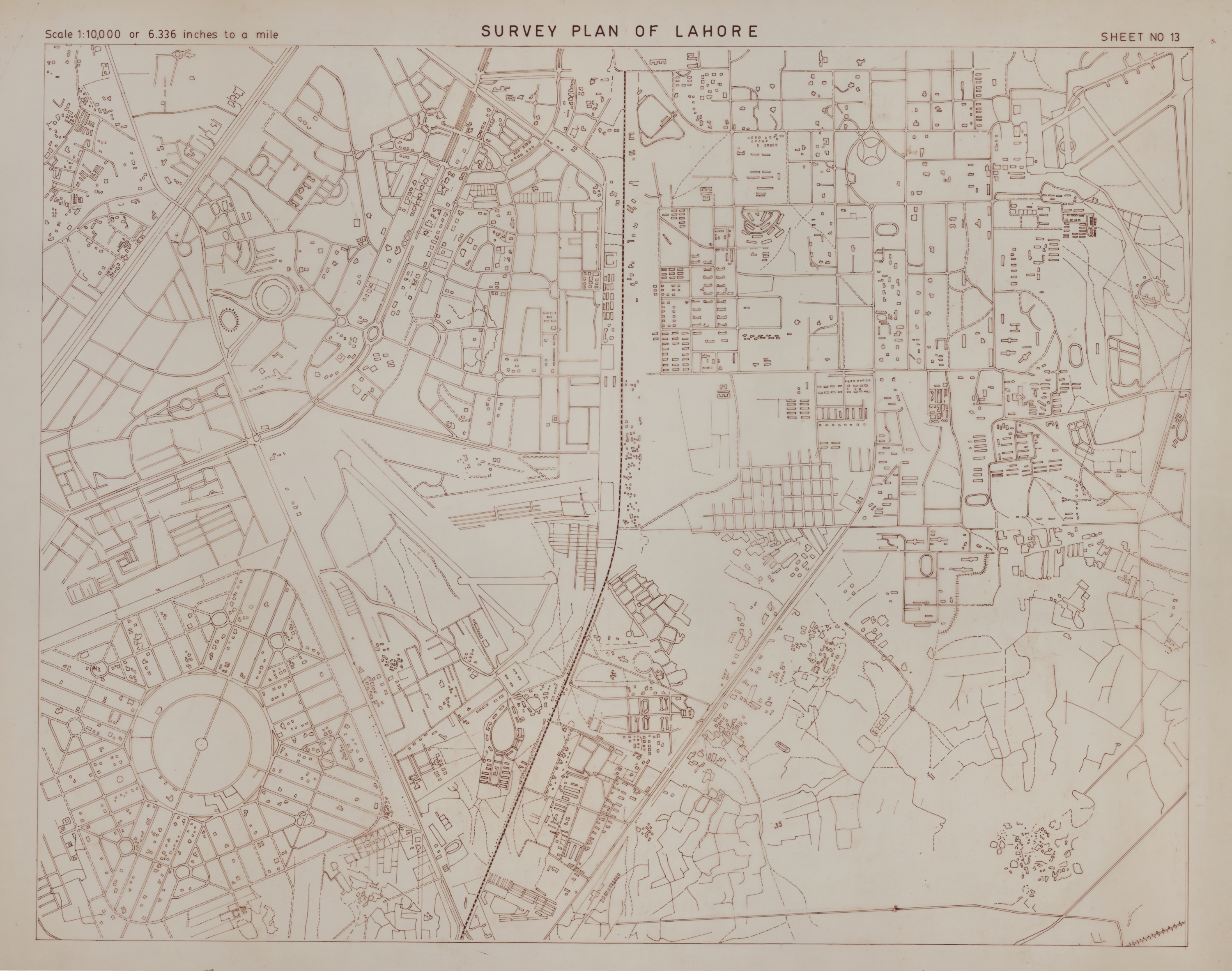
Survey Plan of Lahore
| dc.coverage.temporal | creation date: 1920s | en_US |
| dc.creator | Unknown | en_US |
| dc.date | 1920s | en_US |
| dc.date.accessioned | 2014-01-15T20:40:38Z | |
| dc.date.available | 2014-01-15T20:40:38Z | |
| dc.date.issued | 1920-1929 | en_US |
| dc.identifier | 246599 | en_US |
| dc.identifier.uri | http://hdl.handle.net/1721.3/154983 | |
| dc.description | map, Sheet No. 13 | en_US |
| dc.format.extent | scale: 1:10,000 or 6.336 inches to a mile | en_US |
| dc.format.medium | paper (fiber product) | en_US |
| dc.format.medium | ink | en_US |
| dc.relation.ispartof | 143781 | en_US |
| dc.rights | Courtesy of James Wescoat | en_US |
| dc.subject | Maps | en_US |
| dc.subject | Urban planning | en_US |
| dc.subject | Lahore (Pakistan) | en_US |
| dc.subject | Historical geography --Maps | en_US |
| dc.subject | Land use, Urban | en_US |
| dc.subject | City planning | en_US |
| dc.subject | Plans (maps) | en_US |
| dc.title | Survey Plan of Lahore | en_US |
| dc.type | Image | en_US |
| dc.rights.access | All rights reserved | en_US |
| vra.culturalContext | Pakistani | en_US |
| vra.technique | cartography | en_US |
| vra.worktype | Plan (map) | en_US |
| dc.contributor.display | Pakistani | en_US |
Files in this item
This item appears in the following Collection(s)
-
Aga Khan Visual Archive
Images of architecture, urbanism, and the built environment in the Islamic world